
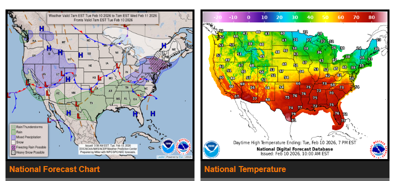
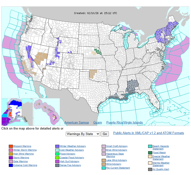
A Pacific storm system will bring lower elevation rain and heavy mountain snow to California and the Sierra over the next couple of days. Coastal areas and the northern and central valleys can expect moderate rainfall, with possible showers and thunderstorms. The Sierra will see heavy snow, and gusty winds are possible. As the system moves inland on Wednesday, precipitation will decrease in California but increase from the Great Basin into the central Rockies. Higher elevations in the Wasatch and Rockies will see moderate to locally heavy snow, while lower elevations will receive lighter rain showers. Some areas could see a brief wintry mix Wednesday evening as temperatures cool, but little to no accumulation is expected.
In the Interior Northeast and New England, a clipper system will bring light to moderate snow, especially from Upstate New York through central and northern New England. Some areas from the northern Mid-Atlantic into southern New England may experience a wintry mix, including light freezing rain. The system will move out by Wednesday, but colder air behind it may produce lake-effect snow near Lakes Erie and Ontario, along with light snow in parts of the Appalachians. Farther south, showers and a few thunderstorms are possible along a cold front stretching from the Ohio Valley to west Texas on Tuesday, with additional storms possible in the Southeast on Wednesday.
Above-average temperatures will continue across much of the country through midweek. Highs will generally be in the 30s and 40s across the northern states, 50s and 60s through the central Plains and Mississippi Valley, and 60s and 70s from the Southwest through the southern Plains into the Southeast. The West Coast and Intermountain West will stay closer to seasonal averages, with highs mainly in the 40s to 60s. New England and the Mid-Atlantic will see temperatures closer to average, with highs in the 20s and 30s in northern areas and 40s farther south.
WYOMING
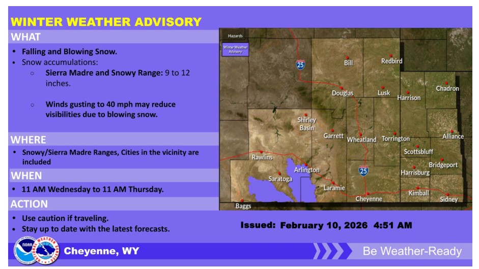
A mid-level system will push into the region Wednesday and Thursday. Snow Accumulations look to be between 9 to 12 inches for the Sierra Madre and Snowy Mountains. A winter weather advisory was issued for the snow amounts and visibility reductions due to blowing snow.
Have a nice and safe day.