
Active Weather Across Much of the U.S.
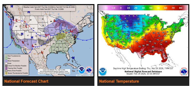
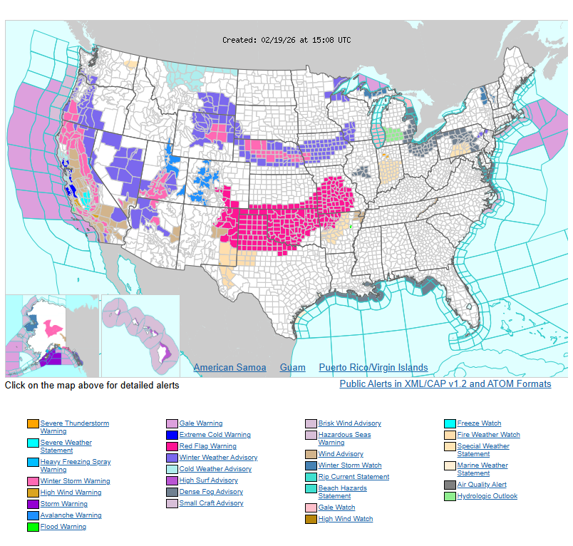
A strong and dynamic storm system will impact large portions of the country over the next few days, bringing winter weather, severe storms, heavy rain, fire danger, and big temperature swings.
🌨 Winter Storm: Plains to Great Lakes & Northeast
- Today: Several inches of snow expected across Nebraska and Iowa.
- Tonight: Light snow and freezing rain spread into the Upper Great Lakes.
- Friday: Snow, sleet, and freezing rain move into the interior Northeast and southern New England.
- Impacts are expected to be mostly minor but could cause travel disruptions.
⛈ Severe Weather Threat
- Today (Midwest): Thunderstorms from the Middle Mississippi Valley to the lower Ohio Valley may produce:
- A few tornadoes
- Large hail
- Damaging wind gusts
- Friday (Southeast & Gulf Coast): Isolated severe storms possible, with hail and gusty winds.
Rain will also spread into the Mid-Atlantic and Northeast this afternoon and evening.
🔥 Fire Weather Concerns
Critical to elevated fire danger continues due to warm, dry, and windy conditions across:
- Northeastern New Mexico
- Texas and Oklahoma Panhandles
- Central Oklahoma
- Southwest Missouri
Another round of critical fire weather conditions is expected Friday across the Southern High Plains.
🌊 West Coast Impacts
- California: Heavy low-elevation rain continues.
- Sierra Nevada: Another round of heavy snow today.
- Over 2 feet likely, with isolated totals exceeding 3 feet by Friday morning.
- Southern California may see isolated thunderstorms with damaging wind gusts.
🌡 Temperature Outlook
- Well above average temperatures from the Southern Plains to the Northeast through Friday.
- Midwest highs in the 60s and 70s (20–30° above normal).
- Record high temperatures possible across the Southeast.
- Below average temperatures continue in the West and will gradually spread eastward this weekend, ending the mild stretch in the East.
WYOMING
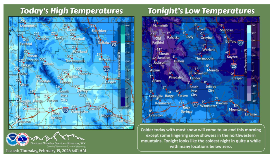
Most snow should end this morning, otherwise expect a much colder day today with clouds breaking for some sunshine. A cold night is on tap tonight with many locations dropping below zero.
Behind the cold front and after the snowfall, expect the much colder air to settle in for the end of the week and into the weekend. Afternoon high for Thursday and Friday morning’s low will be some of the coldest temperatures of the winter for some thus far.
NEBRASKA
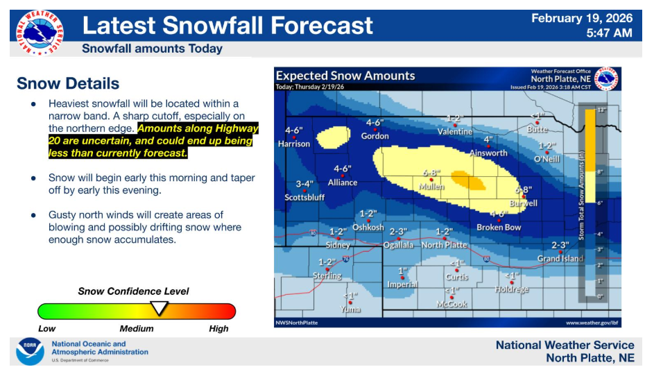
Snow is expected across portions of southwest Nebraska into the Sandhills and central Nebraska today. The heaviest snow should remain north of I-80 across the heart of the Sandhills and into portions of central Nebraska. There will be a sharp cutoff to the snow across northern Nebraska. Amounts are uncertain along and north of Highway 20, and may need to be trended downward. Stay tuned for the latest forecast information.
Have a nice and safe day.