
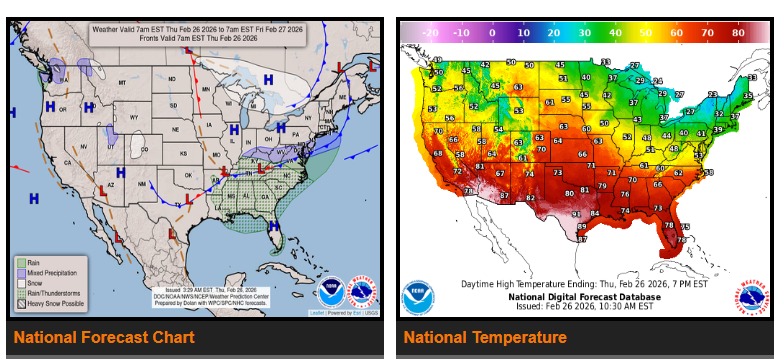
Daily showers and thunderstorms will continue across the Southern U.S. along a cold front that is expected to stall near the Gulf Coast this weekend. Some areas could see 1–2 inches of rain through Saturday. While locally heavy at times, this rainfall will be beneficial for regions currently experiencing drought.
Most of the rest of the Lower 48 will stay dry today. However, a clipper system moving out of the Canadian Rockies will bring light to moderate snowfall from the Northern High Plains into the Upper Midwest Friday into Saturday.
Temperatures will remain well above average across much of the country through the first half of the weekend. The Southwest and Southern Plains will see especially warm conditions, with highs reaching the upper 80s to low 90s in some areas and the potential for record-breaking temperatures through Sunday.
By Saturday, colder air moving in behind the clipper system will bring a noticeable cool-down across the Northern Plains and Upper Midwest. This cooler air will gradually push into the Northeast after the weekend.
WYOMING
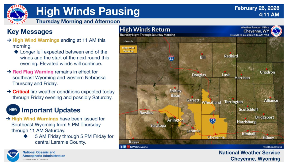
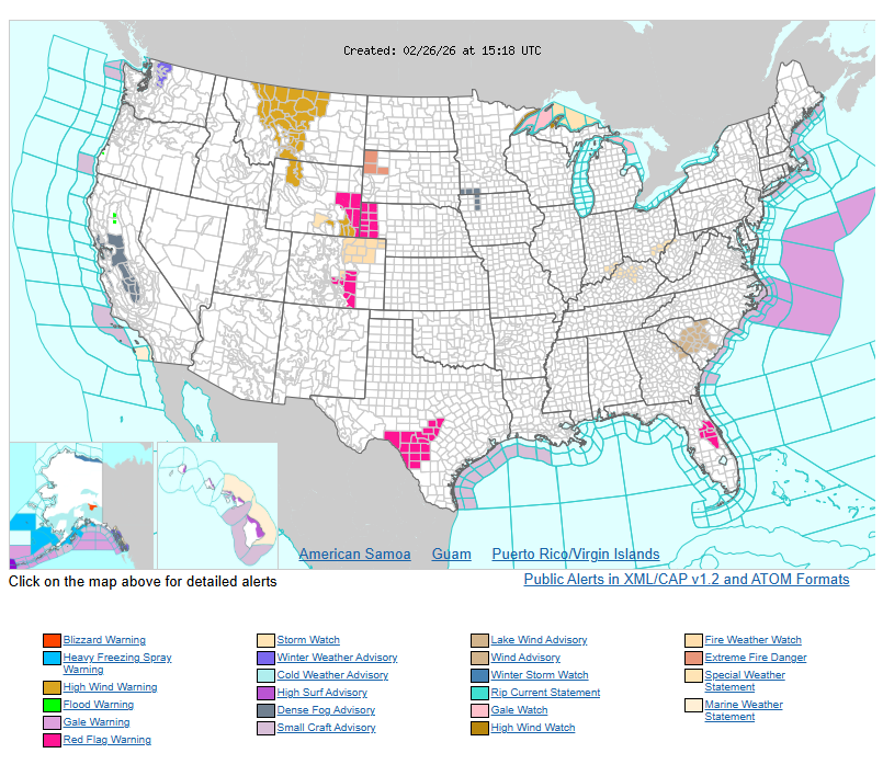
High Wind Warnings end at 11 AM this morning, with a longer lull in winds expected this afternoon and evening. Winds increase again later this evening. New High Wind Warnings have been issued from 5 PM tonight through 11 AM Saturday and 5 AM Friday to 5 PM Friday for Cheyenne.
Have a nice and safe day.