
Hello March!
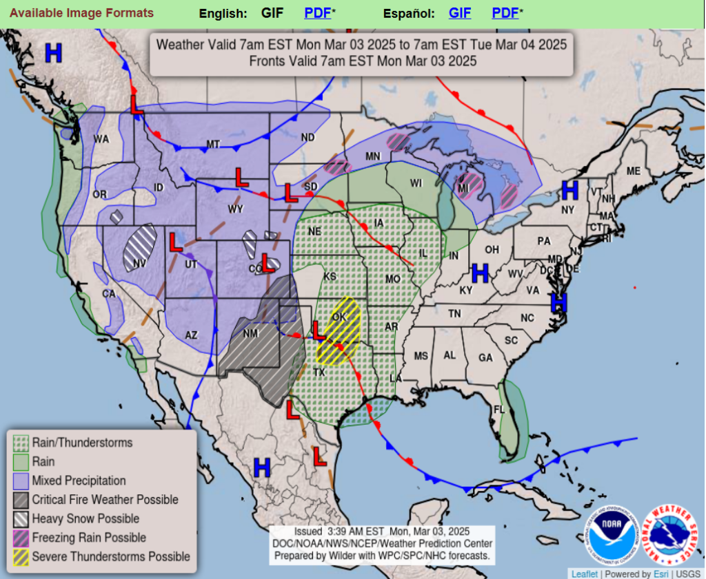
A major winter storm ejecting out into the Central U.S. will bring widespread hazards going through midweek including damaging high winds, blizzard conditions, severe weather, and a concern for some flash flooding.
There is critical to extreme fire weather danger across much of the Southern High Plains going through the early to middle part of the week.
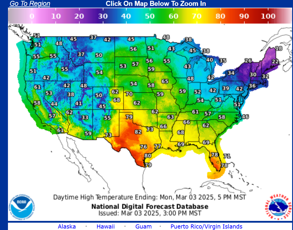
Much above normal temperatures across the Midwest will move into the Eastern U.S. by midweek, with below normal temperatures over the West gradually reaching the Plains.
New Pacific storm system to arrive on Wednesday across California.
Wyoming
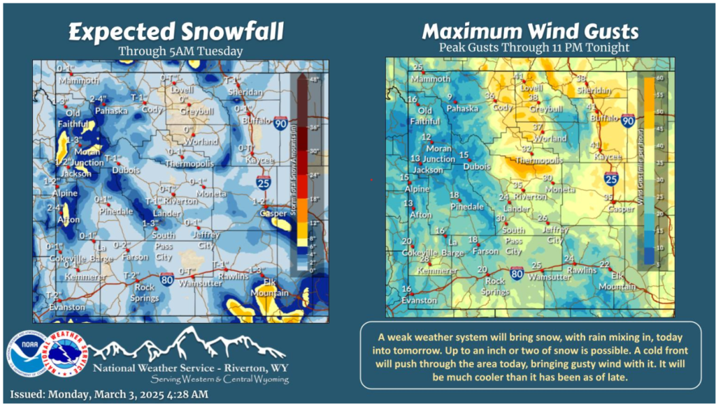
Today marks a change in the pattern as a weak weather system spin through the area today into tomorrow. Scattered light snow showers, with rain mixing in will develop this morning. A cold front will bring cooler temperatures and gusty wind today.
With unpredictable weather this time of year, always check the forecast before hitting the road. Rain, fog, and changing temperatures can create hazardous conditions.
Drive cautiously, keep a safe following distance, and ensure your vehicle is in top shape for the season ahead!
Remember, Safety is #1! Stay safe out there!