
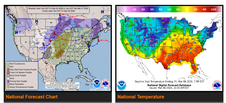
Severe thunderstorms and possible flash flooding are expected from the Central/Southern Plains into the Midwest through Saturday. Some storms may produce large hail, damaging winds, and isolated tornadoes, especially across Missouri, Kansas, Arkansas, Oklahoma, and nearby areas.
Heavy rain may lead to flash flooding, particularly around the ArkLaTex region (Arkansas, Louisiana, Texas).
Meanwhile, winter weather is expected in the Rockies and northern Plains. The central Rockies (Colorado, Wyoming, Utah) could see 3–6 inches of snow in lower elevations and over a foot in the mountains. A mix of snow, sleet, and freezing rain may also impact parts of the northern Plains and Upper Midwest.
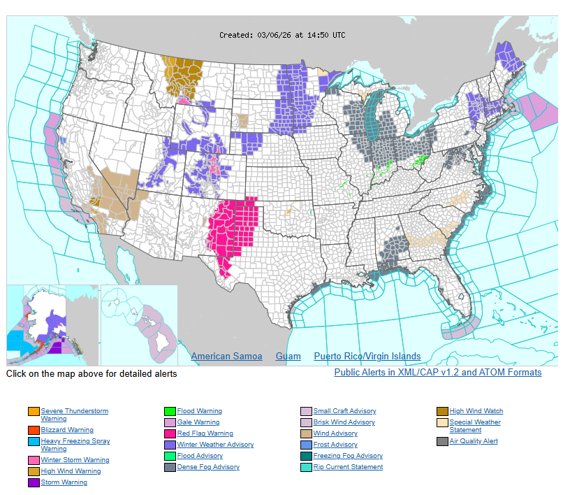
Drivers in the southern High Plains (Texas, New Mexico) should also watch for strong winds and elevated fire weather conditions.
Temperatures will remain well above normal across much of the central and eastern U.S., with highs in the 70s and 80s in some areas before cooler air moves in behind the front this weekend.
WYOMING
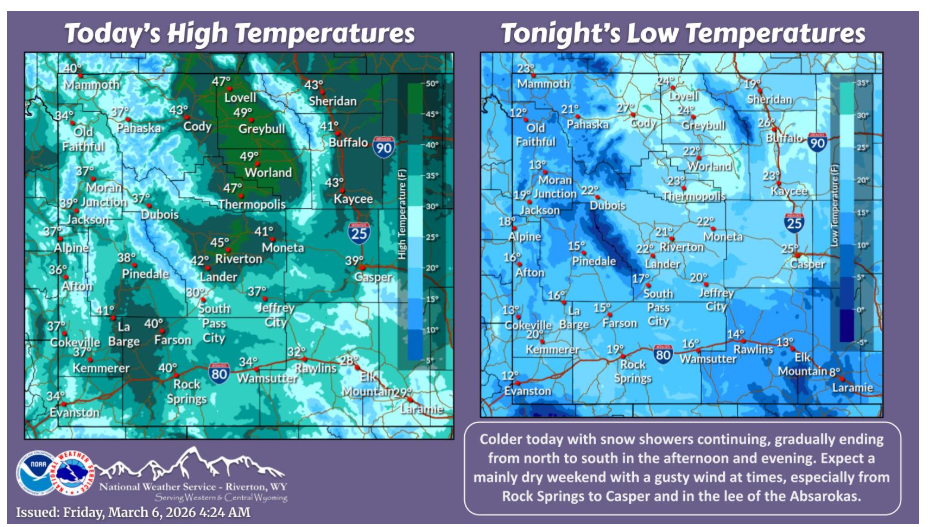
Colder and breezy today with snow showers scattered across the area, most numerous in the morning. Mainly dry and milder for this weekend with a gusty to strong wind in many locations.
NEBRASKA
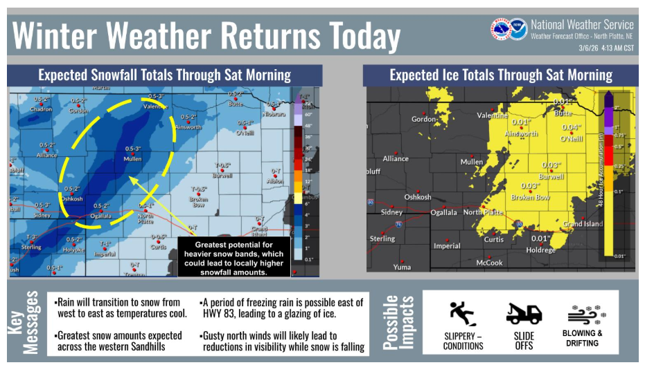
Travel with caution today! Winter weather returns with rain transitioning to snow. Expect a period of freezing rain east of Hwy 83 (icing possible) and gusty north winds reducing visibility, especially in the western Sandhills where the heaviest snow is likely.
Have a good and safe day.