
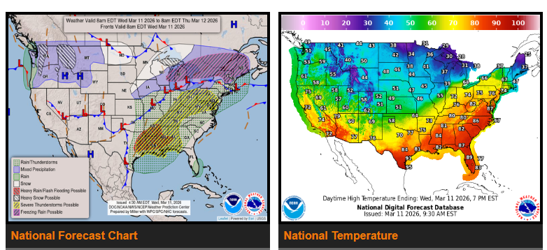
Storms and heavy rain are expected today from Texas and the Lower Mississippi Valley through the Tennessee Valley, Ohio Valley, and into the Mid-Atlantic. Some storms may become severe with strong winds, large hail, possible tornadoes, and flash flooding.
Behind the front, winter weather is possible from the Upper Great Lakes into northern New England, including snow and areas of ice, which may impact travel.
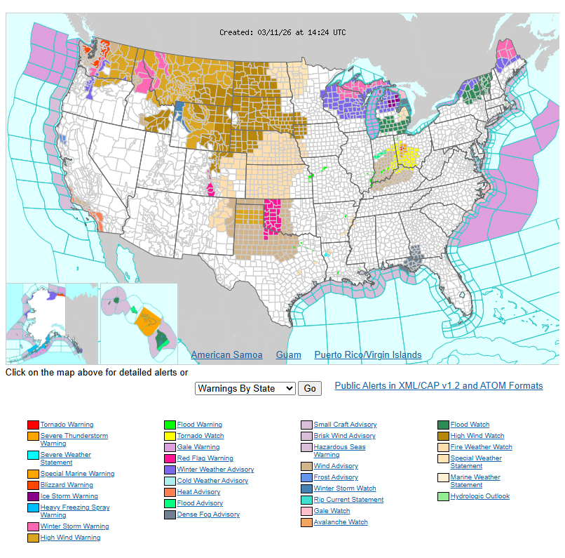
In the Pacific Northwest and northern Rockies (Washington, Oregon, Idaho, and western Montana), an active weather pattern continues with heavy mountain snow, rain at lower elevations, and strong winds. Blizzard conditions are possible in higher elevations.
Temperatures across the eastern U.S. will be very warm today, but a cold front will move through tonight bringing cooler, more seasonal temperatures Thursday.
WYOMING
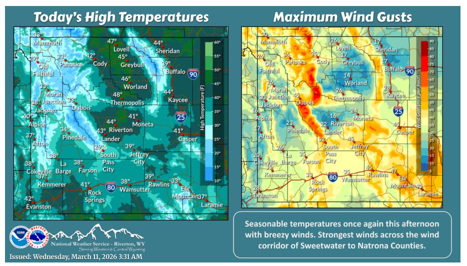
Another seasonable afternoon in store today with breezy winds once again, strongest for the wind corridor of Sweetwater to Natrona Counties. Strongest winds will occur overnight into Thursday.
NEBRASKA
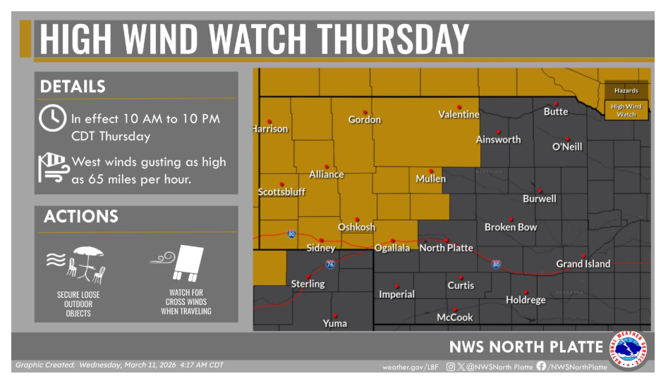
Strong west winds develop Thursday morning and persist into Thursday evening. Wind gusts up to 65 miles per hour are expected for areas along and north of Interstate 80 and west of Highway 83 Thursday. This could provide for difficult travel, especially on north to south routes.
Have a nice and safe day.