
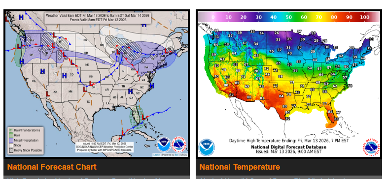
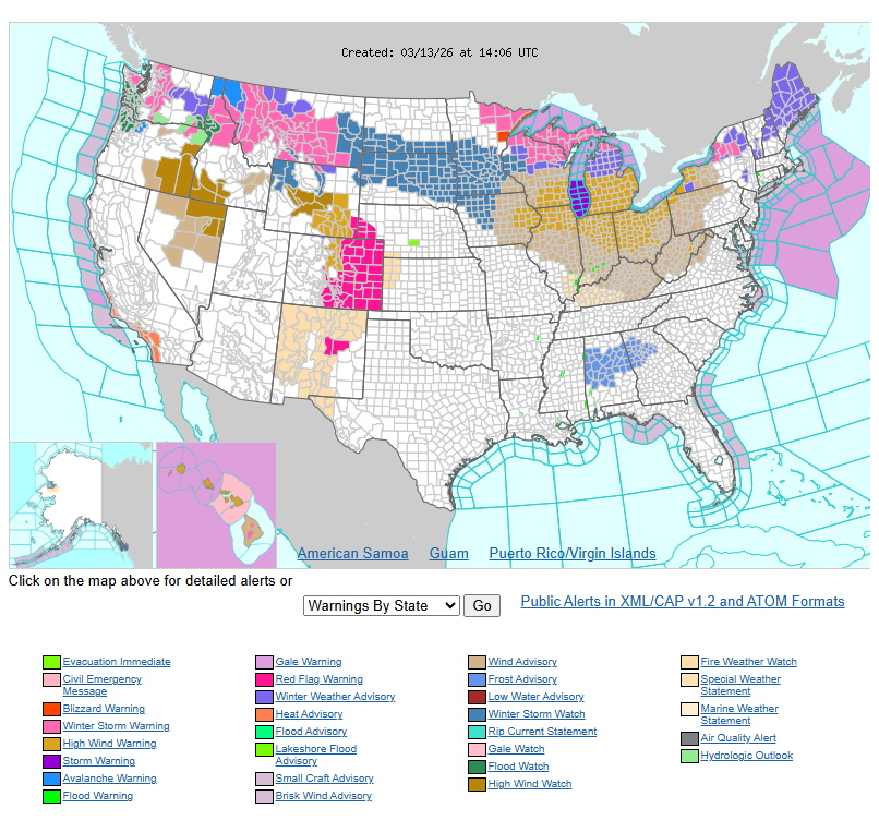
Heavy snow and strong winds are impacting the Upper Midwest and Great Lakes today, with 6–12+ inches possible and areas of blowing snow causing poor visibility. The Pacific Northwest and northern Rockies, including Washington, Oregon, Idaho, Montana, and Wyoming, will see heavy rain at lower elevations and significant mountain snow through the weekend, with totals of 2–4 feet possible in higher elevations.
A winter storm will begin developing across Wyoming and the northern High Plains today and will expand across the northern Plains into the Upper Midwest Saturday night into Sunday, bringing heavy snow, strong winds, and possible blizzard conditions. Across the central and southern High Plains, including eastern Colorado, Kansas, Oklahoma, and the Texas Panhandle, warm temperatures combined with dry air and gusty winds will create critical fire weather conditions on Saturday.
Meanwhile, much of the western U.S., including California, Nevada, and Arizona, will experience unusually warm temperatures heading into the weekend. Drivers should remain alert for strong winds, blowing snow, reduced visibility, and rapidly changing road conditions in affected areas.
WYOMING
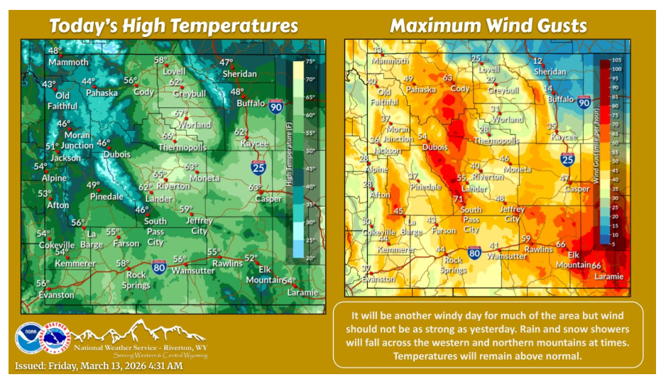
Another windy day is expected today, but not as windy as yesterday. Showers will fall at times across northern and western locations with a continuation of above normal temperatures.
NEBRASKA
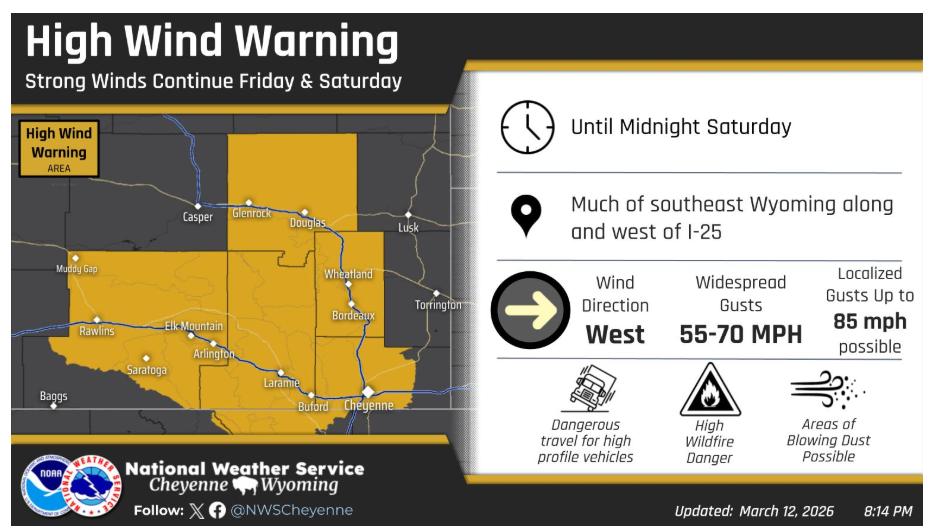
While western Nebraska and far eastern Wyoming will get some relief tonight, High Winds are expected to continue along and west of I-25 through Saturday evening. Friday and Saturday’s winds will not be quite as strong as Thursday, but may still cause localized additional wind damage and present a significant danger to light weight and high profile vehicles.
Have a good and safe day.