
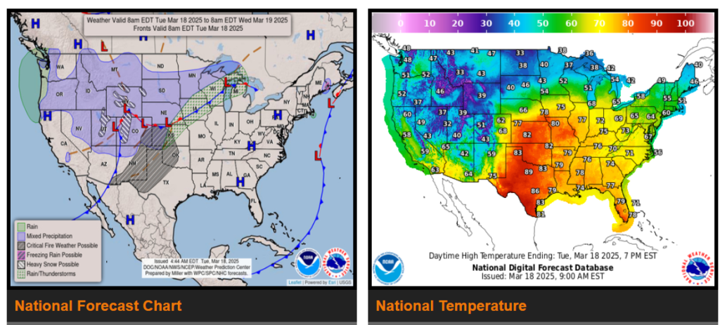
Heavy snow over the Northern/Central Rockies on Tuesday; light to moderate snow from the Central Plains to the Upper Great Lakes on Tuesday; and heavy snow/ blizzard conditions over Central Plains to the Upper Great Lakes on Wednesday.
There is a Slight Risk (level 2/5) of severe thunderstorms over parts of the Middle Mississippi/Ohio Valleys and Upper Great Lakes on Wednesday.
There is an Extreme Risk of fire weather over the parts of the Southern High Plains on Tuesday
Widespread snow and blizzard conditions are expected Tuesday night through Wednesday over portions of the Central Plains into the Midwest.
As the storm moves over the Upper Midwest Wednesday afternoon and night, heavy snow bands become enhanced by Lake Superior. Very difficult and dangerous travel is expected due to the heavy and blowing snow, which causes roads to become snow-covered and dramatically reduces visibility. Avoid travel if possible.
Wyoming
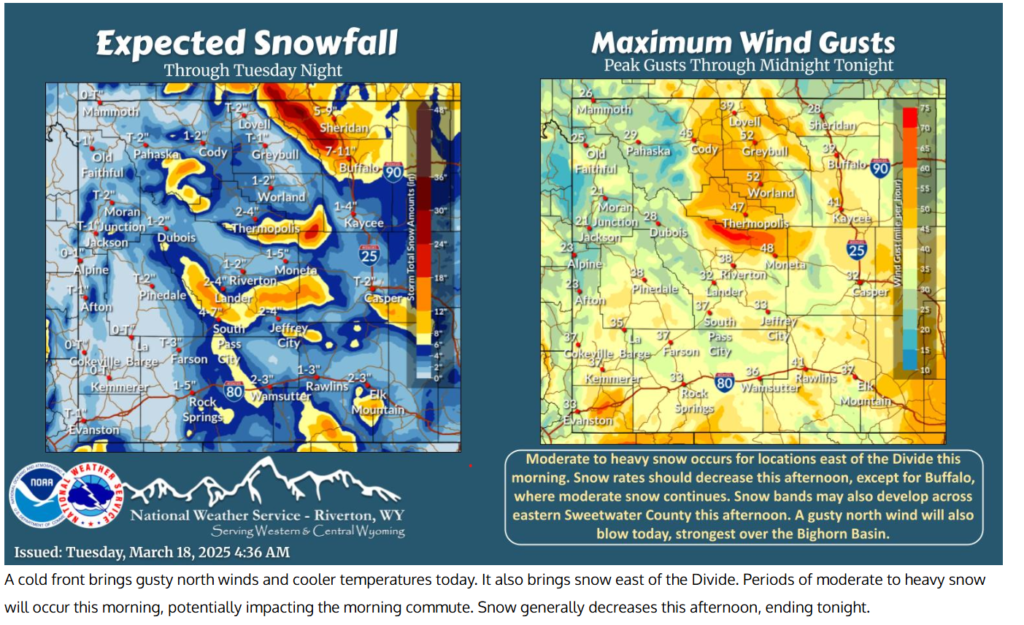
Conditions will change rather quickly during the course of the day Tuesday. The rain is expected to change over to snow during the afternoon across areas west of I-25 and the remainder of southeast Wyoming and the Nebraska panhandle by Tuesday evening. Snowfall amounts will be highest along the Pine Ridge and Cheyenne Ridge where two to four inches will be possible. Otherwise, amounts will generally be less than a couple of inches but will be accompanied by strong north winds gusting at 35 to 45 mph Tuesday evening which will cause some blowing and drifting snow.
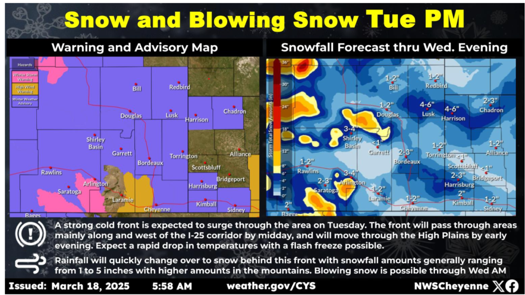
A strong storm system will bring gusty northerly winds, with gusts of 40 to 60 mph. Overnight, precipitation switches over from rain to snow. Gusty winds with falling snow will create areas of blowing snow and reduced visibility overnight, with near whiteout to whiteout conditions expected.
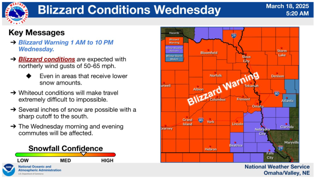
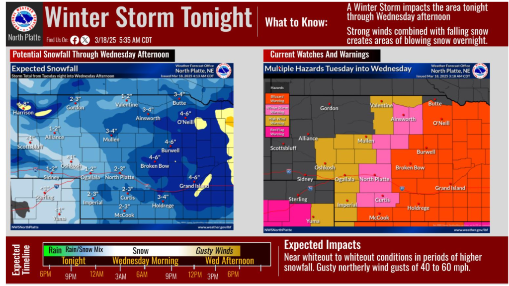
Another potent system arrives late this evening into Wednesday, bringing rain, snow, and gusts of 50-65 mph to Nebraska and Iowa. A Blizzard Warning is in effect for Wednesday with a Winter Weather Advisory to the southeast.