
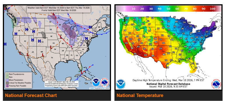
An early-season heatwave is building across the western U.S. and will continue expanding into the Great Plains over the next few days. Temperatures will climb well above normal, with parts of California, the Desert Southwest, and the Great Basin reaching the 80s, 90s, and even 100s. Some areas may see record highs for March. The heat is expected to last through the weekend.
This rapid warming may also cause snowmelt in the mountains, leading to higher river levels and stronger currents. Even with warm air temperatures, water conditions remain dangerous.
Across the eastern U.S., very cold morning temperatures are beginning to ease. After another chilly start, temperatures will gradually return to normal and then above average by the end of the week.
Most areas will stay fairly dry over the next couple of days. The main exception is the Pacific Northwest, especially western Washington, where multiple systems will bring periods of moderate to heavy rain and possible localized flooding. Snow will be limited to higher elevations.
Light snow will move through the Midwest today and into the Great Lakes, followed by a mix of rain and snow Thursday into Friday. Another round of wintry weather is possible in the upper Great Lakes late Thursday into Friday.
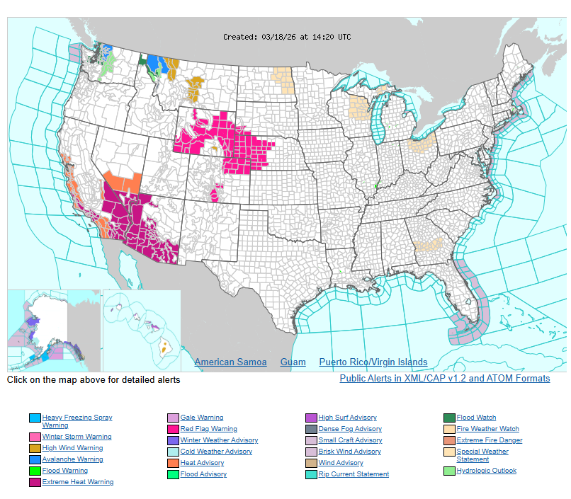
Fire weather concerns are increasing in Wyoming through early Friday due to warm, dry, and gusty winds. Similar windy conditions are expected in parts of Montana.
WYOMING
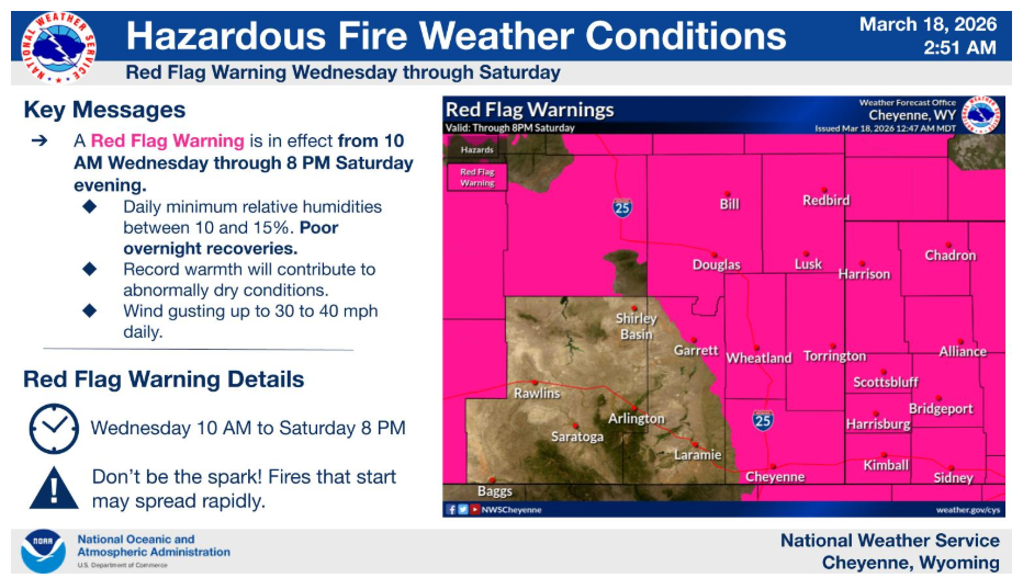
A Red Flag Warning is in effect for much of the area from 10 AM today through 8 PM Saturday evening. Critical fire conditions are expected every afternoon with gusty winds and very dry conditions. Rapid fire spread will be possible every day. Outdoor burning is not recommended.
Have a good and safe day.