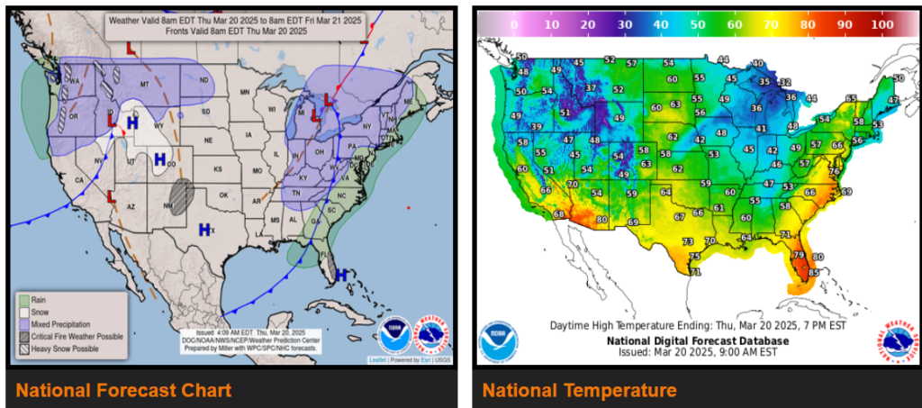
Major late winter/early spring snowstorm to push into the Upper Mississippi Valley and Great Lakes.
Severe weather possible this evening across much of Illinois and Indiana.
Light to moderate snow over the Cascades and Northern Intermountain Region; light snow over the Great Lakes, Central Appalachians, and Northeast
There is a Critical Risk of fire weather over the parts of the Southern High Plains and Florida on Thursday and an Elevated Risk over the Central/Southern Plains and Middle/Lower Mississippi Valley on Friday.
By Friday evening, the systems will produce light snow over the Upper Great Lakes into the Upper Mississippi Valley. Showers and thunderstorms will also develop over parts of the Middle Missouri/Middle Mississippi Valleys on Friday.

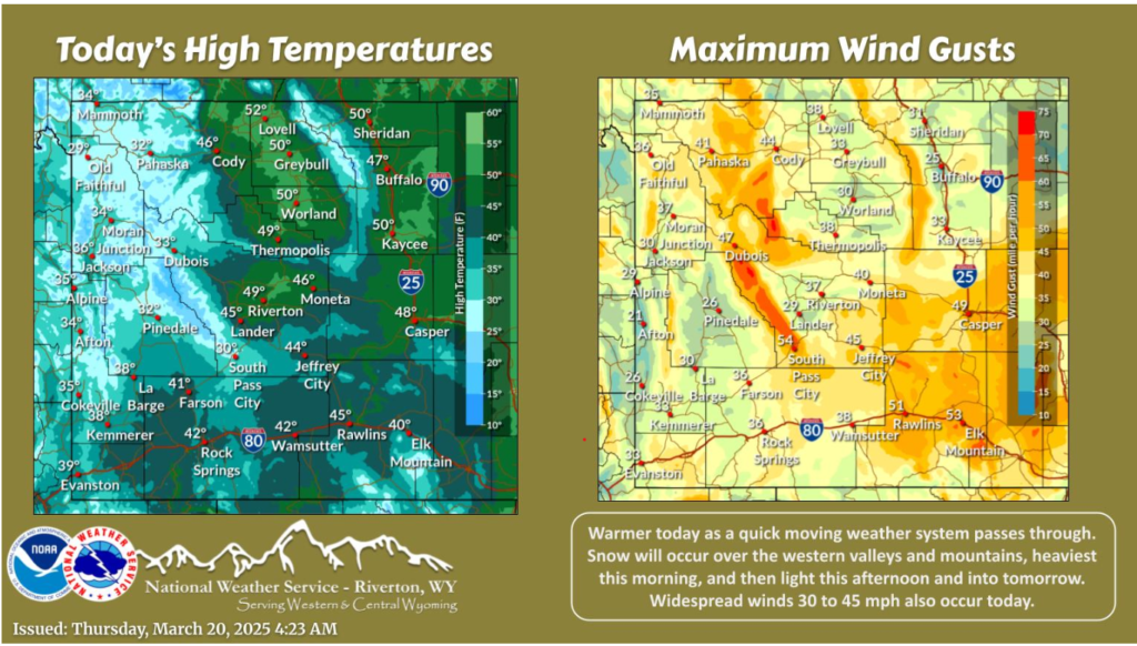
Wyoming

Warmer today as a quick moving weather system passes through. Snow will occur over the western valleys and mountains, heaviest this morning, and then light this afternoon and into tomorrow. Widespread winds 30 to 45 mph also occur today. Strongest winds will be around Outer Drive in Casper and along South Pass, where gusts around 60 mph are possible.

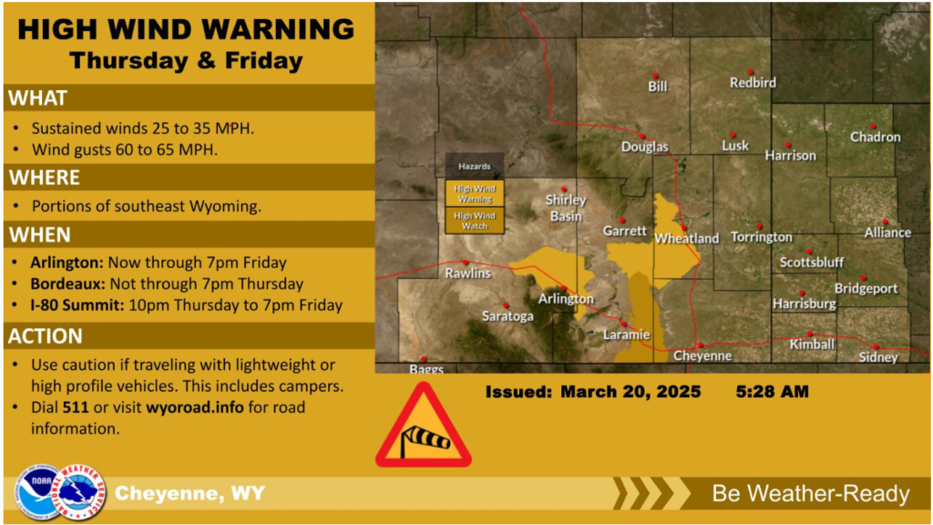
March 20th, 5:30am – High Wind Watches have been expanded to include the I-80 Summit and upgraded to High Wind Warnings for Arlington and Bordeaux. Some timing differences exist for these watches and warnings, with Arlington and the I-80 Summit ongoing until 7pm Friday. Use caution if driving lightweight or high-profile vehicles, including campers.
Nebraska

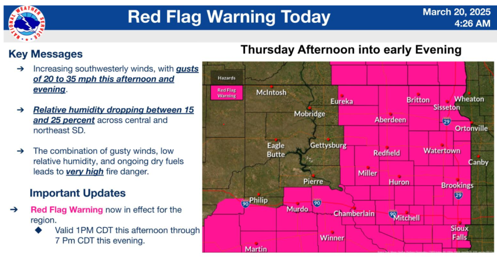
A Red Flag Warning has been issued for this afternoon into this evening. Southwest gusts of 20 to 35 miles per hour and humidity dropping between 15 and 25 percent cause the elevated fire weather concerns. When combined with dry fuels, these conditions cause a Very High Grassland Fire Danger Index
Safety first!
Drive safe out there.
