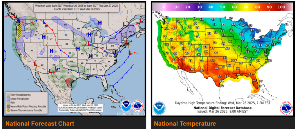
Heavy rain and flash flooding potential emerging across southern Texas later today and continuing into Thursday.
Thunderstorms could become severe across the Pacific Northwest tonight, and across southern Texas on Friday.
Periods of light snow expected from the Great Lakes to the Northeast as record warmth spreads from the western U.S. into the central U.S.

Wyoming

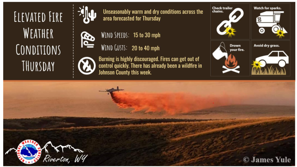
Possible record-breaking high temperatures, low RH, and gusty wind will result in elevated fire weather conditions on Thursday this week. Burning is not recommended on Thursday.
With the warm temperatures this week there will be some melting of snow in the mountains around the area, mainly east of the Continental Divide. This will result in rising rivers and streams, but flooding is not expected to occur. Thursday into Friday would be the peak of river rises.

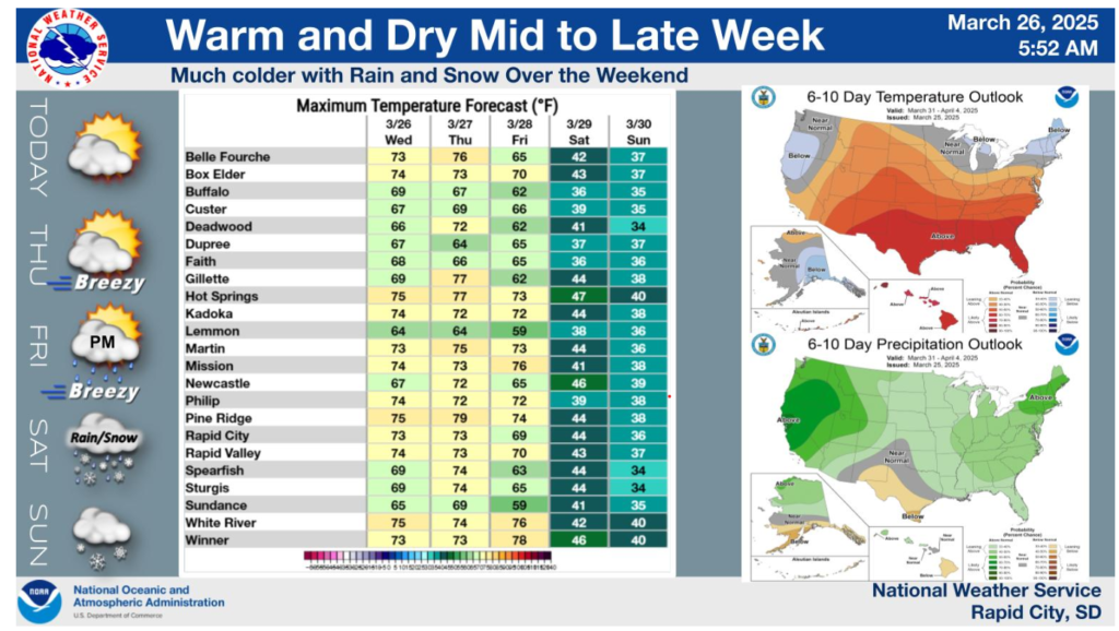
Warm conditions can be expected for the next few days, with highs in the 60s and 70s. Mainly dry weather can be expected into Friday, with breezy conditions at times producing elevated fire danger, especially from parts of northeast Wyoming to southern South Dakota. The next cold front and upper level system will approach the area late Friday and move across the region over the weekend. Rain and snow chances increase, with beneficial precipitation possible in many areas over the weekend. Some snow accumulations are looking more likely across the area, especially the higher elevations. Milder temperatures will return early next week. The outlook for our area next week slightly favors above average temperatures and above average precipitation.

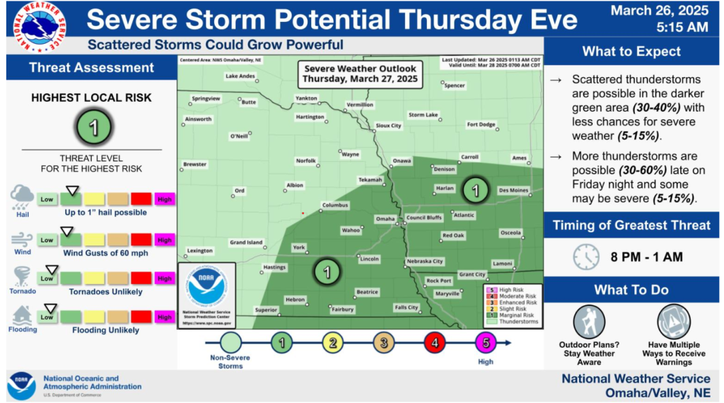
Scattered thunderstorms are possible in southeastern Nebraska and southern Iowa on Thursday evening. Some storms may grow strong enough to produce damaging hail or wind gusts. Tornadoes are unlikely.
Remember safety is our #1 priority, please drive safe out there and enjoy the warm weather.
