
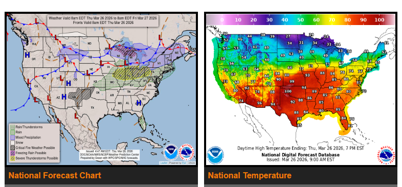
Record-breaking heat continues today, expanding from the Southwest and Plains into the Midwest. States most impacted include Kansas, Oklahoma, Nebraska, Missouri, Illinois, and Indiana, with temperatures running 25–35 degrees above normal.
A strong cold front will move through later today, bringing severe thunderstorms to parts of Missouri, Illinois, Indiana, and Ohio this afternoon and evening. Drivers should be prepared for large hail, strong winds, and possible isolated tornadoes.
Behind the front, much colder air moves into the central U.S. by Friday, with temperatures dropping 20–30 degrees. Areas across the Rockies, including Wyoming and Montana, may also see gusty winds and light wintry precipitation.
WYOMING
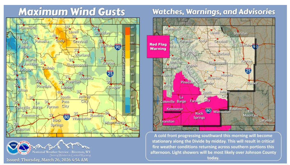
Temperatures will be cooler today, but still above normal for most locations. Critical fire weather conditions will return over southern portions this afternoon. Precipitation will be mainly confined over Johnson County through the day.
NEBRASKA
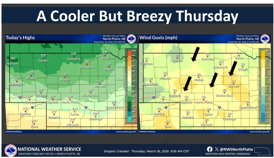
A passing cold front brings cooler temperatures and gusty winds across western and north central Nebraska this afternoon. Northerly winds of 15 to 20 mph are expected to gust up to 40 mph this afternoon.
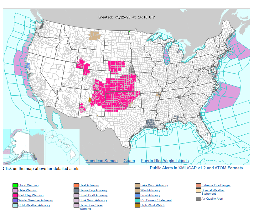
Please use caution in high winds and storm areas, and plan routes accordingly.