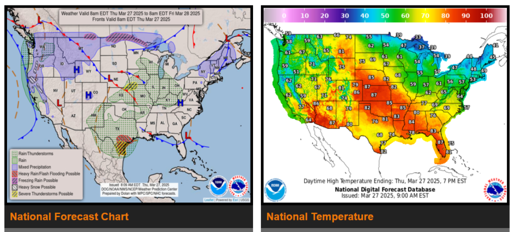
Periods of excessive rainfall are forecast to slowly shift east from southern Texas today, into the upper Texas coast on Friday, and into Louisiana Friday night and Saturday morning.
Snow and ice expected to develop over the northern Plains close to the Canadian border on Friday and then expand toward the upper Great Lakes Friday night.
Windy and wet weather continues for the Pacific Northwest as thunderstorms could become severe across portions of the central Plains and southern Texas today.
A strong ridge of high pressure over the western U.S. will begin to shift eastward into the mid-section of the country through the next couple of days, bringing anomalous warmth into the central Plains where record high temperatures well into the 70s to near 90 degrees are forecast at the hottest locations by this afternoon.

Wyoming

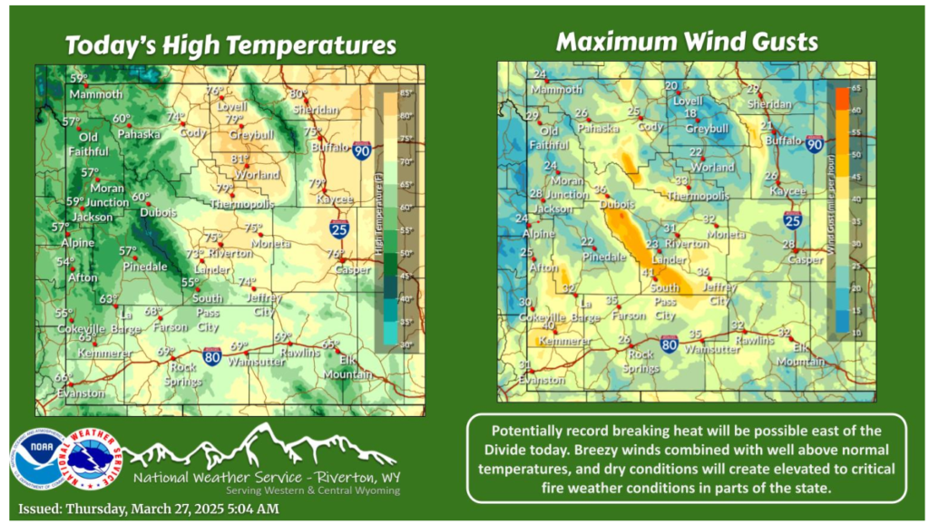
Well above normal temperatures are forecast for many locations east of the Divide today. There is the potential for multiple daily and monthly high temperature records to be tied or broken. Breezy winds combined with these warm temperatures and dry conditions will create elevated to critical fire weather conditions in portions of the state.

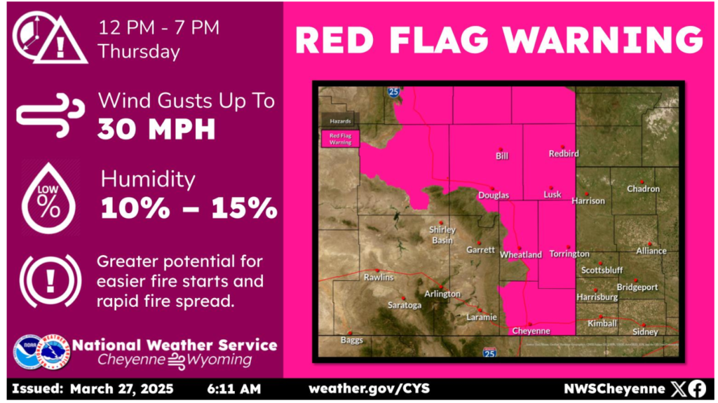
Warm temperatures and gusty west to southwest winds will increase the fire danger today across the area. Red Flag Warnings have been issued for much of eastern Wyoming. In addition, a few scattered showers this afternoon may produce locally gusty winds and a few rumbles of thunder, with little to no rainfall expected. Avoid activities that might cause a spark!
Have a fantastic day and drive safe out there!
