
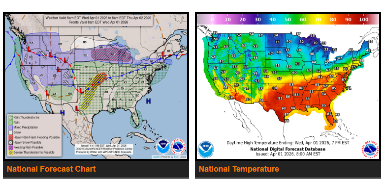
A strong weather system will impact multiple regions over the next couple of days.
Severe thunderstorms are expected across parts of the Central and Southern Plains, including Kansas, Oklahoma, and Texas, with risks of strong winds, hail, heavy rain, and a few tornadoes. Localized flash flooding is possible, especially in low-lying areas, roads, and urban locations.
Rain and freezing rain will extend from the Northern Plains through the Upper Midwest and into the Northeast, with some light snow possible in the Northern Plains.
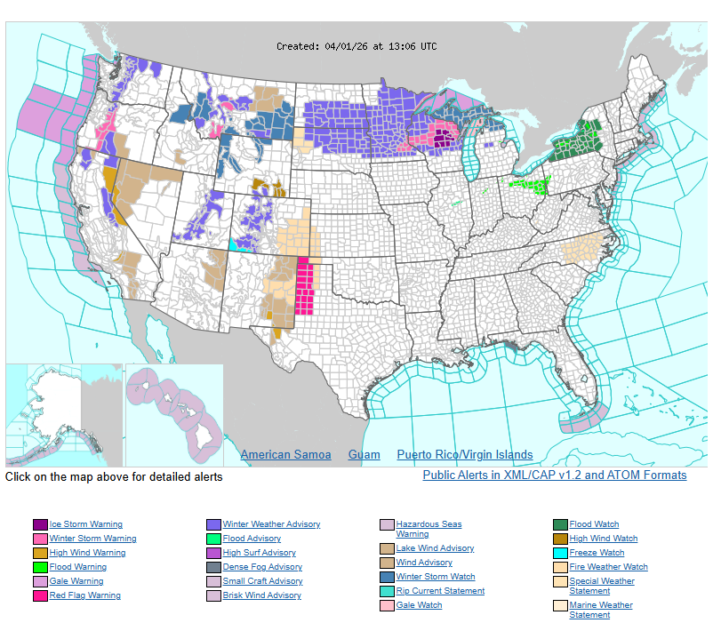
Heavy snow is expected across the Northern Plains and Upper Midwest, which may create difficult travel conditions. Rain and freezing rain will continue across parts of the Great Lakes and Northeast.
Additional severe thunderstorms may develop across the Upper Midwest, Great Lakes, and Ohio Valley, bringing the potential for strong winds, hail, and isolated tornadoes.
Out West, rain and mountain snow will continue across the Northwest, Northern Rockies, Great Basin, and Sierra Nevada.
Please plan routes accordingly and use caution in affected areas.
WYOMING
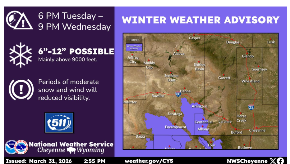
A Winter Weather Advisory is in effect for the Snowy and Sierra Madre Ranges this evening through Wednesday evening. Snow accumulations of 6 to 12 inches are possible, mainly above 9000 feet. Moderate snow mixed with gusty winds could lead to reduced visibility.
Have a nice and safe day.