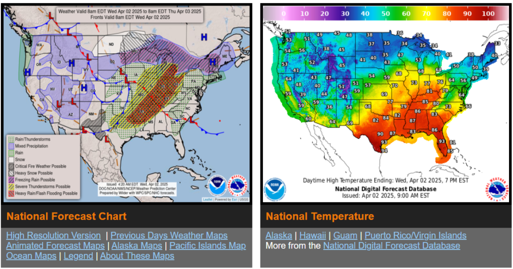
Life-threatening, potentially historic flash flood event begins Wednesday for the Lower Ohio Valley and Mid-South.
Tornado outbreak expected Wednesday for the Mid-South with multiple intense tornadoes possible.
Late season winter storm continues Wednesday for portions of the Northern Plains/Upper Midwest with heavy snowfall expected.
Unsettled weather continues over the West as an upper-level trough passes over the region.
Critical Risk of fire weather for portions of the central/southern High Plains and Southwest Wednesday.

Wyoming

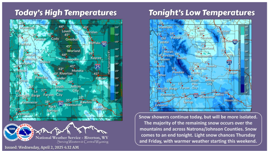
Another day of snow showers for portions of the area. Most snow will be over the mountains, and across Johnson/Natrona Counties. Isolated snow showers are possible elsewhere. Snow comes to an end tonight. Some light snow chances occur Thursday and Friday, before a warm up starting this weekend.

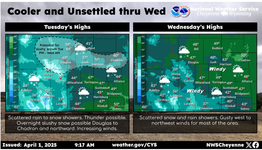
Cooler and more unsettled weather will continue for today and tomorrow. Expect increasing winds today with scattered rain transitioning to snow showers. A few rumbles of thunder are possible too. The best chance for some slushy snow accumulation this afternoon through Wednesday morning is along the corridor from Douglas to Chadron, but there is still quite a bit of uncertainty. Gusty west to northwest winds will continue through Wednesday with another round of scattered rain and snow showers.
Have a wonderful day and be safe out there.
