
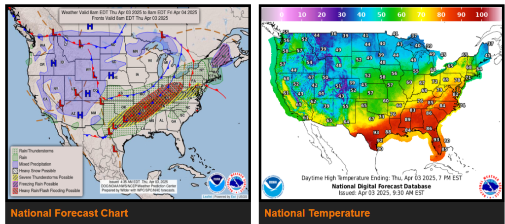
Life-threatening, catastrophic, and potentially historic flash flood event continues across the Lower Ohio Valley and Mid-South.
A couple rounds of significant severe weather expected from the Mid-South west through the Ozarks and ArkLaTex with very large hail and strong tornadoes possible.
.Moderate to locally heavy snow showers expected for the Rockies, with some snow showers spreading eastward into the High and Northern/Central Plains.
Well above average, very warm Spring temperatures to end the week across the Southeast with numerous record-tying/breaking highs possible.
Wyoming
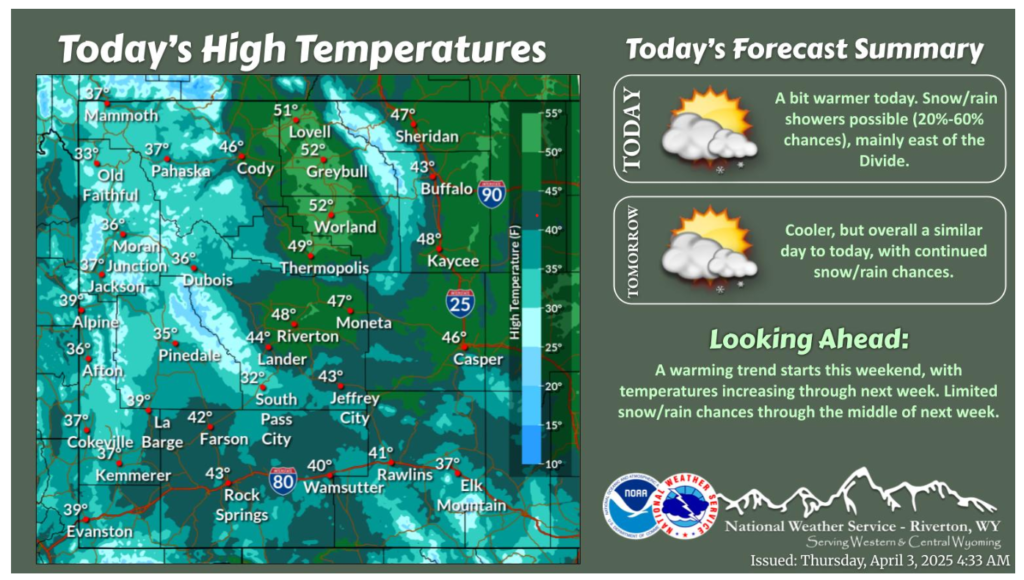
A little warmer today. There will be rain/snow showers around again today, mainly east of the Continental Divide. Cooler tomorrow, with continued snow/rain chances. Warmer temperatures start this weekend, continuing into next week.
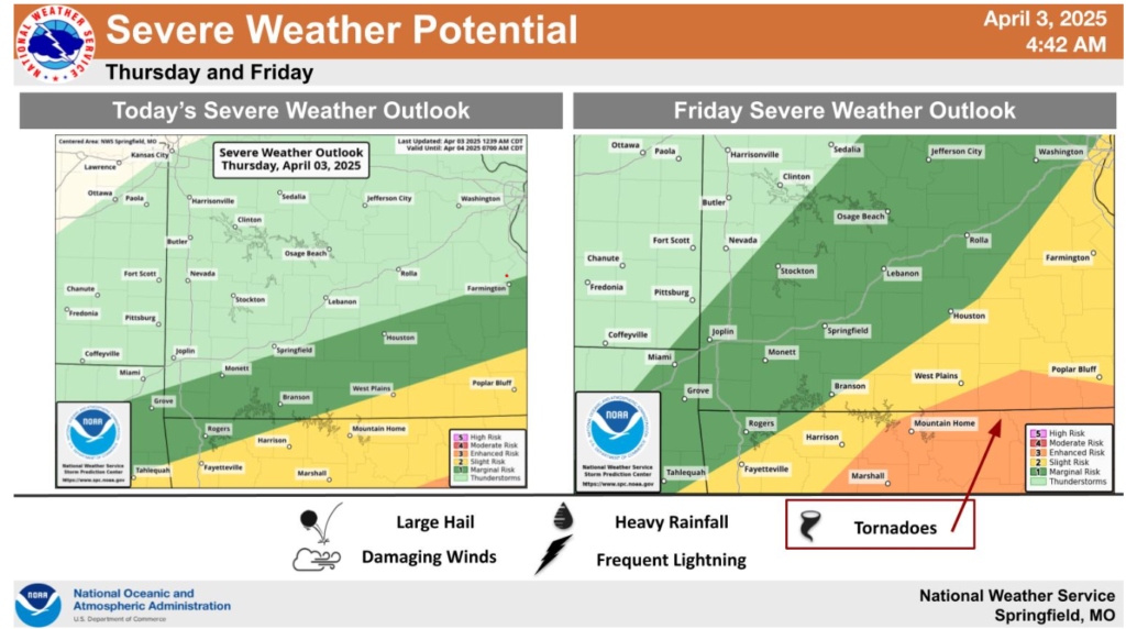
Unsettled weather will continue through the end of the week and into the weekend. Strong to severe storms will be possible today and Friday. Large hail will be the predominant severe weather risk today, while all modes of severe weather will be possible Friday, especially south of a warm front over south central Missouri.
Have a wonderful day and drive safe out there.