
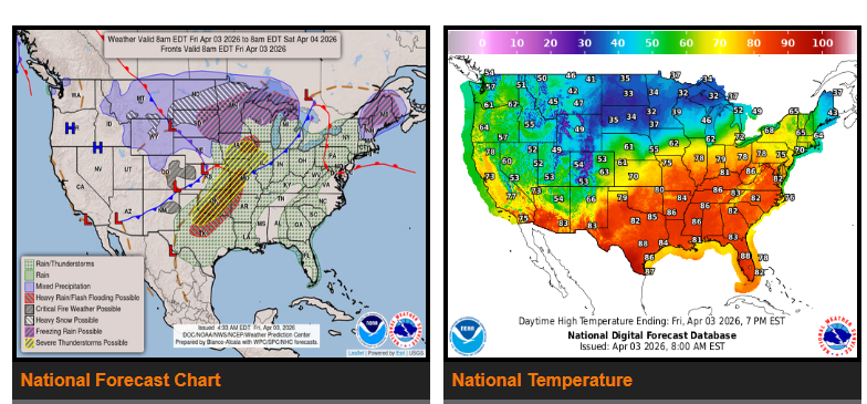
Strong to severe thunderstorms are expected today from the Central and Southern Plains into the Ohio Valley. Areas at highest risk include Missouri, Iowa, Oklahoma, and parts of Texas, with the potential for large hail, damaging winds, and possible tornadoes.
Heavy rain is also expected across the Southern Plains into the Ozarks and Missouri Valley, which could lead to localized flooding.
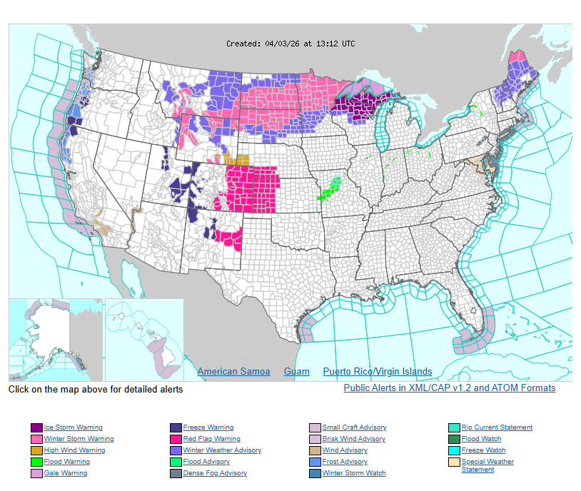
To the north, winter weather will impact the Northern Plains, Upper Midwest, Great Lakes, and parts of New England. Expect a mix of snow, sleet, and freezing rain, with some areas seeing up to 8 inches of snow and higher elevations reaching 12–18 inches. Strong winds may create hazardous travel conditions, and icing is possible from South Dakota into Wisconsin and Michigan.
Temperatures will be warm ahead of the system, with highs in the 70s and 80s across the Central and Southern Plains into the Eastern U.S. Behind the front, colder air moves in, with the Northern Plains seeing temperatures drop into the 30s.
WYOMING
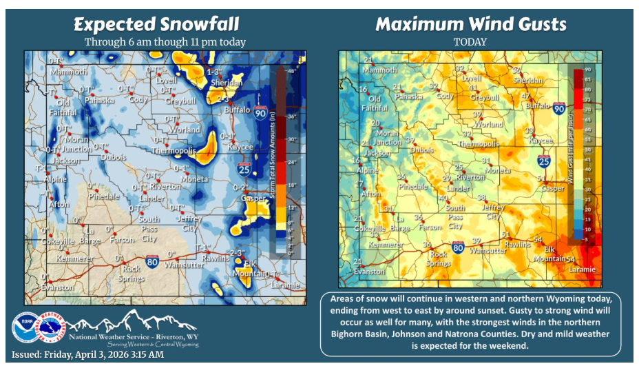
Areas of snow continue across western and northern Wyoming today, ending from west to east through the afternoon. Gusty to strong wind will accompany the snow East of the Divide bringing reduced visibility.
Have a nice and safe day.