
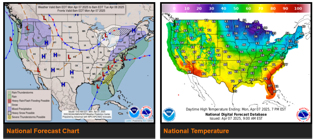
Moderate to heavy rain and strong to severe thunderstorms expected from southeast Virginia to the central Gulf Coast Monday.
Winter weather returns from parts of the Great Lakes to the interior Northeast and northern New England through Tuesday.
Strong cold front to bring much colder temperatures to the Eastern U.S. through Wednesday.
A series Pacific storms will bring unsettled weather to the Pacific Northwest and the northern Rockies through midweek.
Out West, a series of Pacific storms will bring episodes of unsettled weather to the Pacific Northwest and the northern Rockies through midweek. These frontal systems will bring Pacific moisture inland, leading to intermittent shower activity each day.
Wyoming
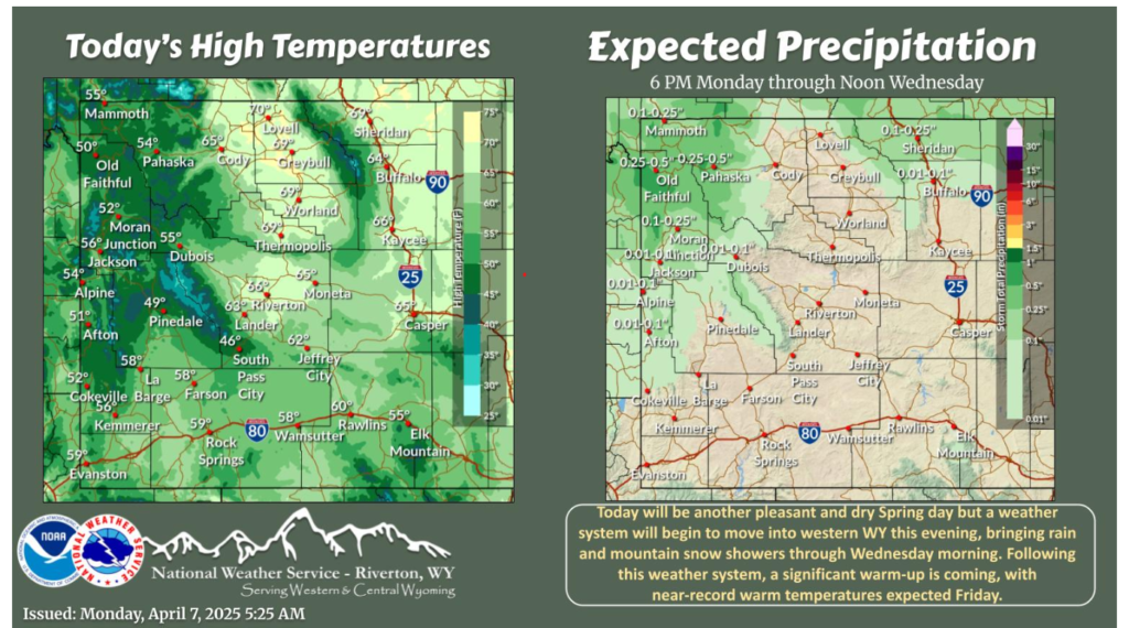
Today remains warm with mostly clear skies through sunset this evening. A weather system will move into western WY after dark, bringing scattered shower and thunderstorm chances to western and northern WY through Wednesday morning. A significant warm-up is on the way for late week, with near record warm temperatures expected on Friday!
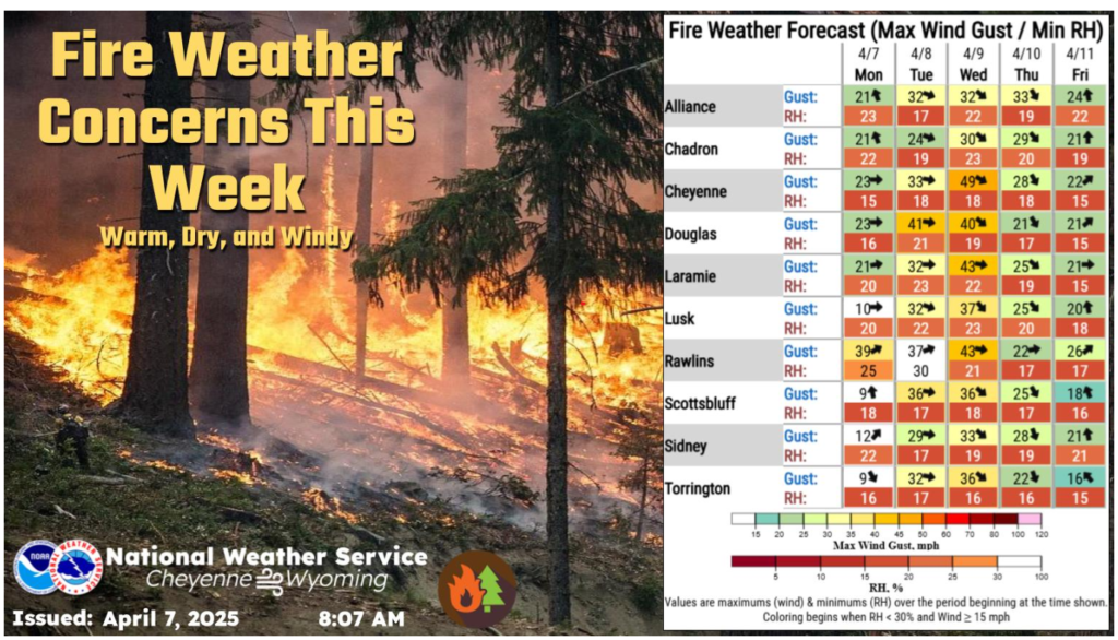
The combination of mild to seasonably warm temperatures, very dry air, and gusty winds will result in increased fire weather conditions this week.
NWS Forecast
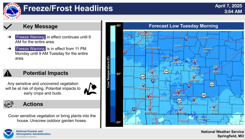
Chilly overnight temperatures are expected this morning and again tonight. A Freeze Warning until 9 AM this morning. Another Freeze warning has been issued for the entire area from 11 PM tonight night into 9 AM Tuesday.
Numerous roads, low water crossings, and waterways continue to see flooding, especially over south-central and southeast Missouri.
Have a wonderful day and drive safe out there.