
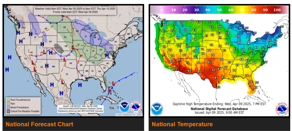
Below normal temperatures continue across the East while well above normal and near-record warmth builds across the West.
Severe weather expected across portions of the Mid/Deep South and Tennessee Valley on Thursday.
Pair of low-pressure systems to bring increasingly unsettled weather to much of the East Thursday into Friday.
In the wake of a strong cold front, temperatures across much of the Eastern U.S. will continue to run 10 to 20 degrees below normal on Wednesday. After a very chilly start with lows nearing, at, or below freezing for many, high temperatures will range from the 20s and 30s across the northern interior sections of the Northeast, to the 30s, 40s, and 50s, from the Upper Midwest to the Mid-Atlantic. Farther south, highs will top out in the 50s, 60s, and 70s from the Ohio Valley and southern Mid-Atlantic to the Southeast and Gulf Coast.
WYOMING
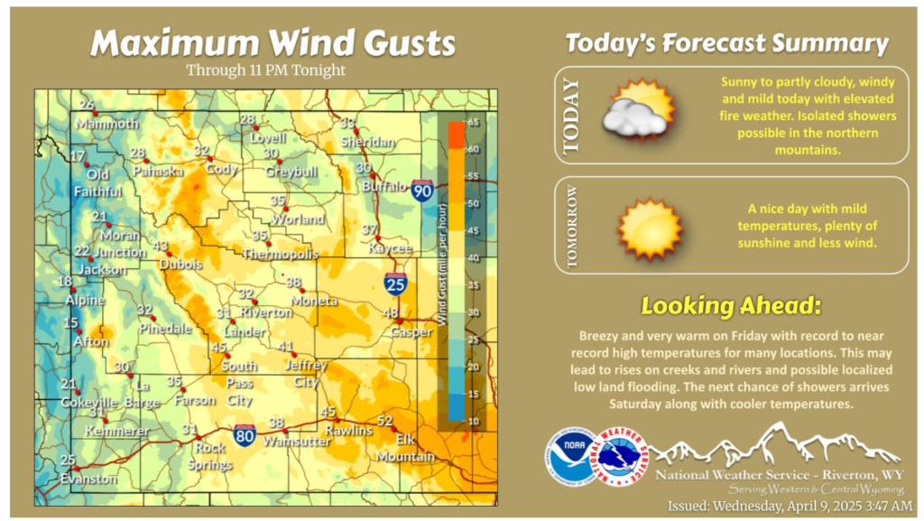
Another mild and windy day today with elevated fire weather across much of the area. Remaining warm through Friday before a cold front brings showers and cooler temperatures for the weekend.
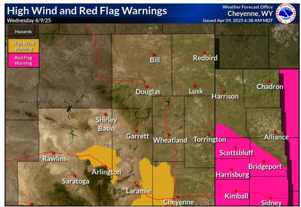
We have upgraded the High Wind Watches to High Wind Warnings for a few of the wind prone areas of southeast Wyoming. Red Flag Warning is in effect for the central/southern Nebraska panhandle for today. West winds will gust between 55 to 65 mph for the wind prone areas, and 40 to 55 mph elsewhere.
Have a wonderful day and drive safe out there!