
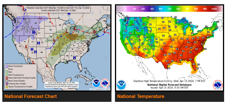
Late-season snow is expected in the Cascades and northern Rockies, while much warmer, almost summer-like temperatures continue across the Mid-Atlantic.
Strong to severe thunderstorms are possible today into tonight across the southern Plains, Midwest, and lower Great Lakes, with another round expected Thursday across parts of the interior Northeast, especially upstate New York. These storms may bring heavy rain, damaging winds, hail, frequent lightning, and a few tornadoes. Storm activity should begin to decrease late Thursday, with lingering showers continuing into Friday morning across New England.
In the Pacific Northwest, a cold front is bringing a sharp drop in temperatures along with gusty winds and mountain snow. Snowfall could reach up to a foot in the Cascades and northern Rockies, spreading into the central Rockies by Friday. Rain may also change to snow across parts of the northern Plains early Friday.
Meanwhile, much of the eastern U.S. will see above-average temperatures, with highs reaching into the 90s across the Mid-Atlantic. This warmer pattern will continue through Thursday before slightly cooling down on Friday.
WYOMING
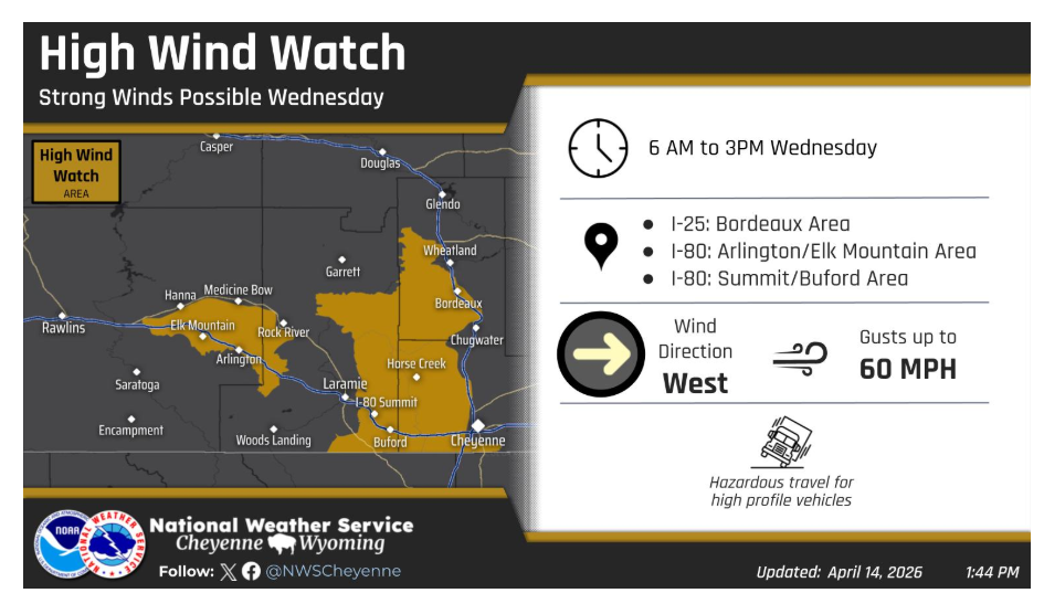
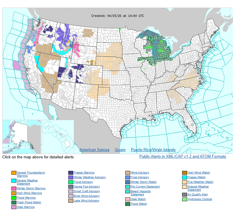
Winds will increase in the wind prone areas again early Wednesday morning. A High Wind Watch has been issued for the potential for wind gusts to around 60 mph. Use caution if traveling with light weight or high profile vehicles.
Have a nice and safe day.