
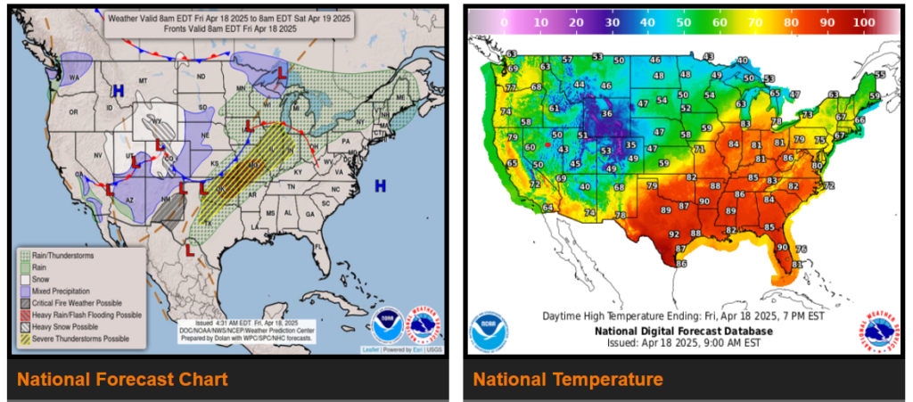
Scattered severe thunderstorms are possible from parts of the southern Plains northeastward toward the upper Great Lakes, mainly from late afternoon into early Saturday morning. Large to very large hail and severe wind gusts should be the main hazards, especially across the southern Plains where storms will be more concentrated. A few tornadoes also appear possible.
WYOMING
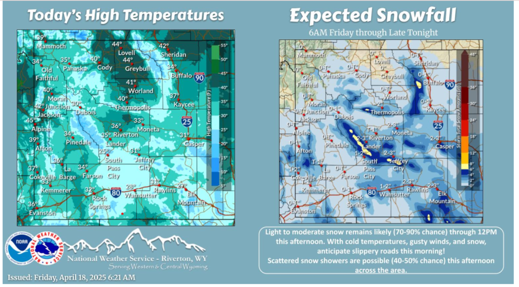
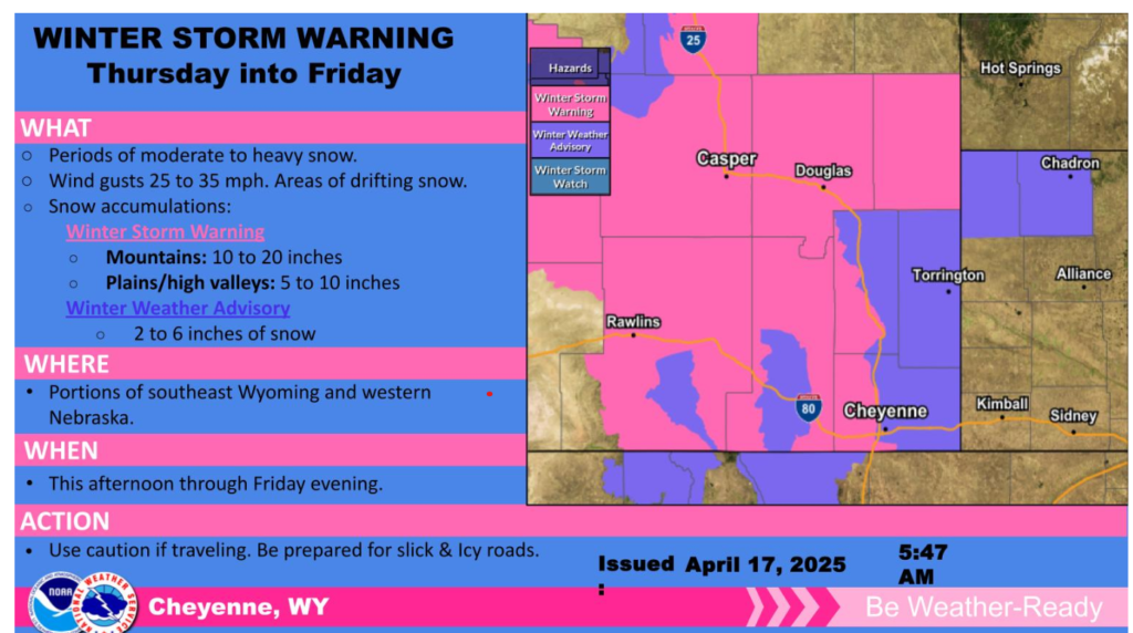
Periods of light to moderate snow remains likely (70-90% chance) for areas East of the Divide through 12PM this afternoon. Scattered snow chances are possible across much of the area this afternoon as well. Colder temperatures, snow showers, and gusty winds could cause slippery roads so take it slow!
Snowfall is limiting visibility and resulting in slick roads in spots. Take it slow if you encounter winter travel conditions, and remember to check the latest conditions and closures with WYDOT before you travel.
As we monitor current weather conditions, please remember that safety is always our top priority.
Here are a few key reminders:
- Check forecasts regularly before heading out.
- Slow down and increase following distance in poor visibility or slick roads.
- Keep emergency supplies on hand, including water, snacks, a flashlight, and warm gear.
- Stay in communication – notify dispatch or your supervisor if conditions worsen.
- Take breaks if weather is impacting focus or causing fatigue.
We appreciate all that you do and want you to make it home safely. Don’t hesitate to reach out if you need support or guidance.
Stay safe and take care,