
Light to moderate snow over parts of the Upper Great Lakes on Monday.
There is a Marginal Risk of excessive rainfall over parts of the Southern Plains on Tuesday.
There is a Slight Risk of severe thunderstorms over parts of the Central/Southern Plains on Tuesday.
On Monday, a front extending from the Upper Mississippi Valley/Upper Great Lakes to the Ohio/Tennessee Valleys and Lower Mississippi Valley/Western Gulf Coast will move eastward to the Northeast/Mid-Atlantic Coast westward into the Tennessee Valley by Wednesday. Showers and thunderstorms will develop along and ahead of the boundary from the Great Lakes/Ohio Valley southwestward to the Lower Mississippi Valley/Western Gulf Coast. An area of strong to severe thunderstorms will develop over parts of the Eastern Ohio Valley.

WYOMING

Similar temperatures today as it was yesterday but with stronger winds across much of the area. Some rain/snow showers this morning pushing quick to the east. Thunderstorm development possible by mid afternoon across the Bighorn Basin but no significant impacts are expected.
NEBRASKA
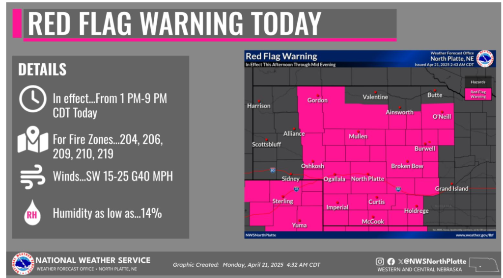
A Red Flag Warning in effect today from 1pm to 9pm CDT.
Have a fantastic day!