
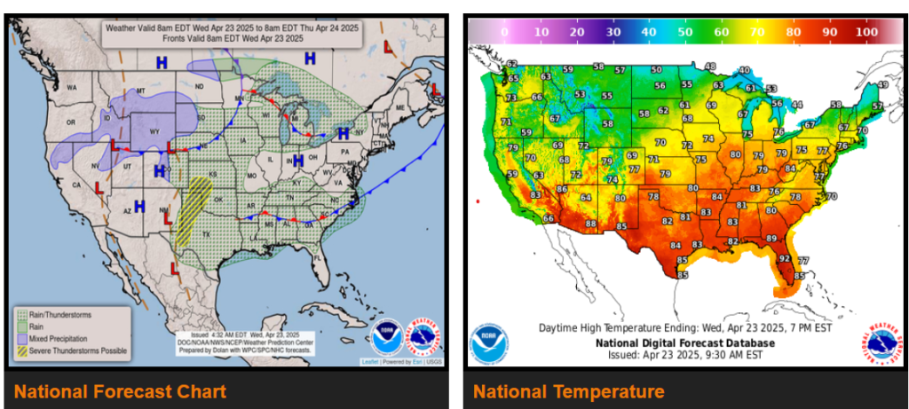
There is a Slight Risk of excessive rainfall over parts of the Central/Southern Plains and Middle /Lower Mississippi Valley on Thursday.
On Wednesday, a front extending from the Upper Mississippi Valley to the Central Plains/Central Rockies will move eastward to the Northeast, westward to the Middle Mississippi Valley, and southwestward into the Southern Plains by Friday morning.
Furthermore, a second front over the southern Mid-Atlantic westward to the Lower Mississippi Valley will linger over the area for the next two days. The two boundaries will produce showers and thunderstorms with moderate to heavy rain over parts of the Central/Southern Plains Lower Mississippi Valley into the Southeast and southern Mid-Atlantic.
WYOMING
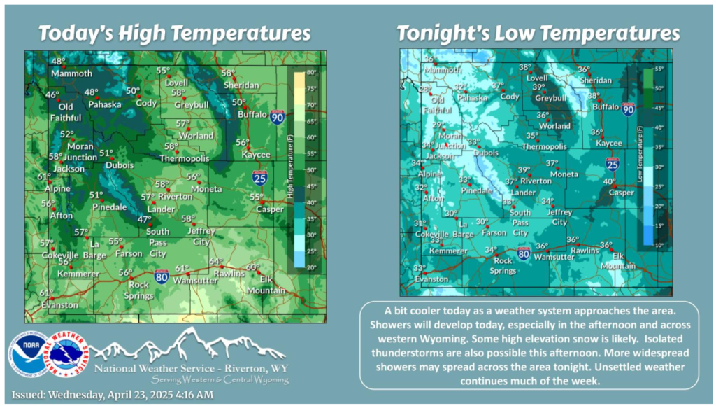
Cooler today with showers and high elevation snow spreading into western Wyoming. Isolated t-storms are possible this afternoon. More widespread showers spread across the area tonight.
NEBRASKA
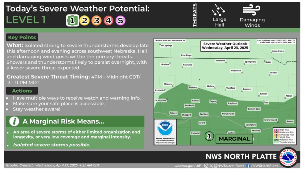
There is a Marginal Risk (Level 1 of 5) for severe thunderstorms this afternoon and evening across southwest Nebraska. The primary severe threat will be large hail and damaging wind gusts. Showers and thunderstorms are expected to last through the night, with the severe threat winding down after midnight.
Have a good and safe day.