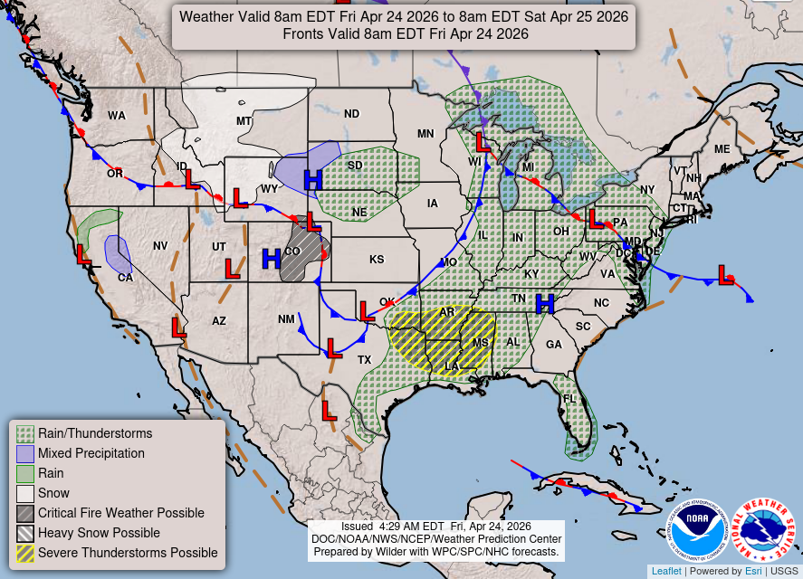
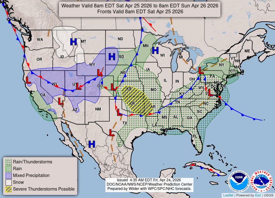
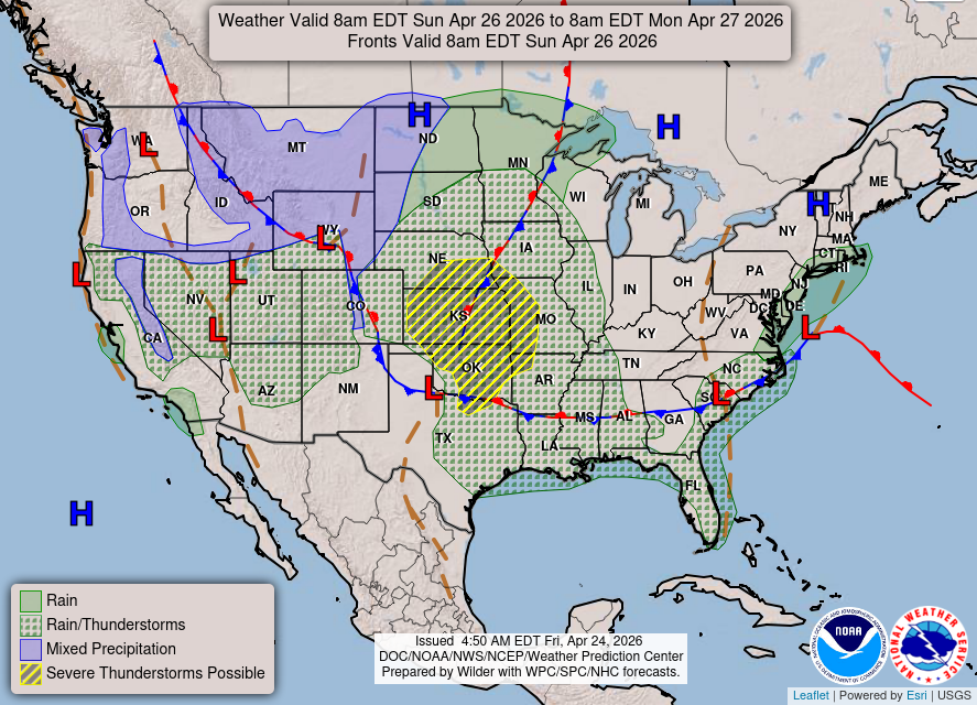
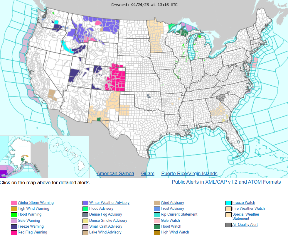
Active spring pattern across the center of the nation with several rounds of severe thunderstorms in the forecast through the weekend. The regions under the greatest threats are the southern Plains into the Mississippi Valley. Meanwhile, dry and breezy conditions with dry fuels are aiding in wildfires across the western High Plains and the Southeast. Wind and some snow for northern Rockies
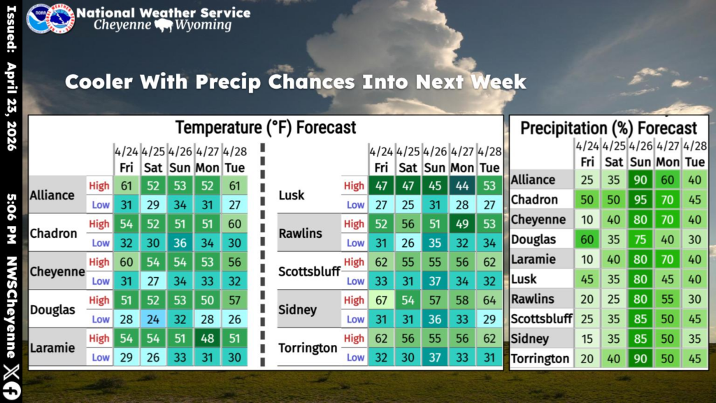
A pattern change will result in cooler temperatures and additional precipitation chances over the next few days for southeast Wyoming and western Nebraska. An approaching storm system will bring the greatest chance on Sunday, with some locations potentially receiving one-quarter inch of moisture.