
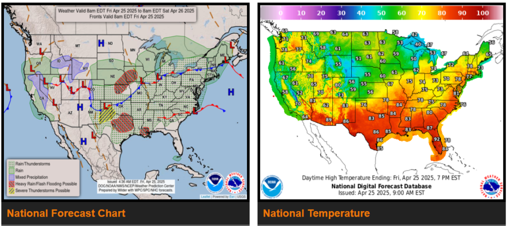
Scattered strong to severe thunderstorms persist over the central to southern High Plains through the next couple of days with fire weather threat over the southern Rockies.
Much below average temperatures spreading across California into the western Great Basin but much above average temperatures stretch through the Rockies and from the Southern Plains into the East.
Over the central to southern High Plains, the potential of strong to severe thunderstorms will persist for the next couple days as upper-level energies ejecting out of the Rockies interact with a front dropping south into the central Plains where large hail is expected to be the greatest threat, and lesser chances of tornadoes and high winds. This region of the country has been very active over the past week with another round of showers and thunderstorms likely to develop late Friday afternoon into Friday night and Saturday.
WYOMING
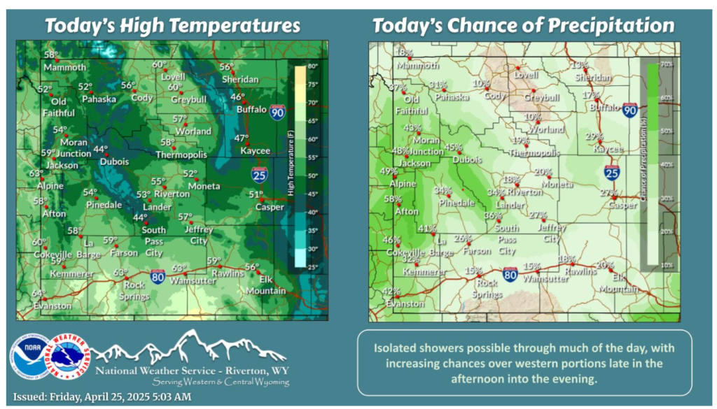
Cool conditions and overcast skies will be in place today with isolated showers possible. Western portions will have the best chance for showers and even an isolated thunderstorm late this afternoon into the evening.
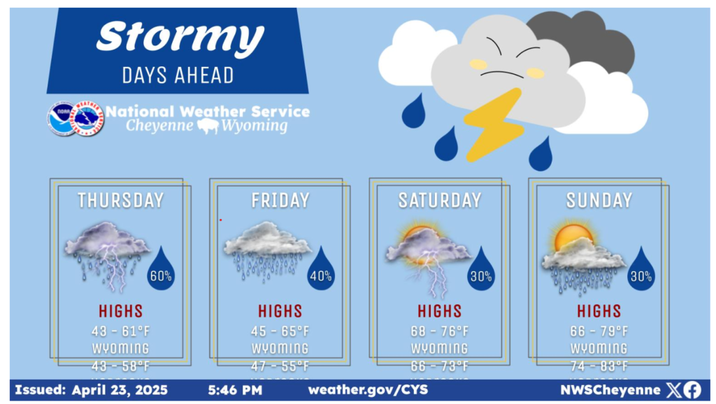
The upper-level pattern over the next few days will be conducive for multiple precipitation chances. The best chance for widespread precipitation will be Thursday, with precipitation chances decreasing throughout the weekend. Mostly cloudy days are expected on Thursday and Friday with the sun returning this weekend.
NEBRASKA
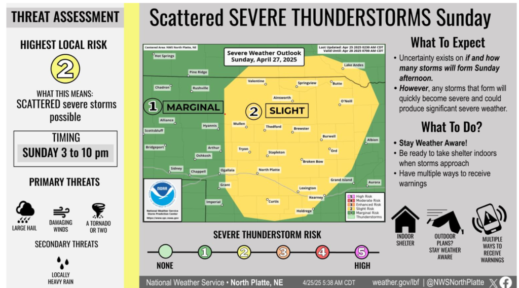
Uncertainty exists on if and how many storms can form ahead of a dryline on Sunday afternoon across western Nebraska. However, any storms that form will pose a threat for significant severe weather, including large hail, damaging winds, and a tornado or two.
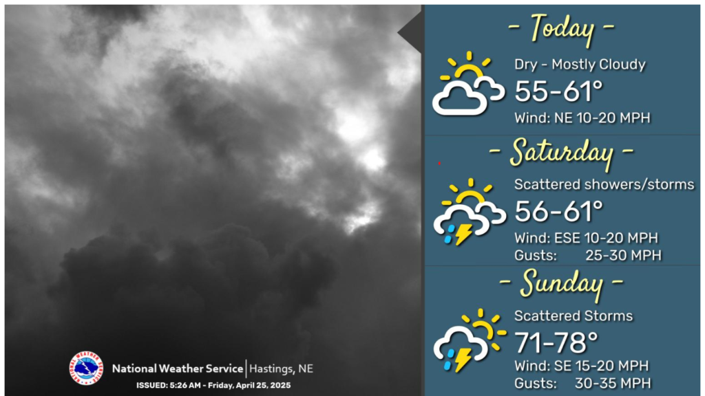
Any lingering shower will come to an end by the mid-morning hours. Mostly cloudy to overcast skies are expected today with highs in the mid 50s to low 60s. Northeast winds will be breezy at times, gusting 20-25mph. Precipitation chances return to the area after midnight, mainly across southwestern portions of the area. Scattered shower/storm chances (30-70%) continue across the area on Saturday. Highs on Saturday will be in the mid 50s to low 60s. Warmer weather arrives on Sunday as highs climb into the 70s. Scattered thunderstorm chances continue on Sunday. A few storms on Sunday may be strong to severe. Southeast winds will be breezy on Sunday, gusting 30-35mph.
Have a nice and safe weekend.