
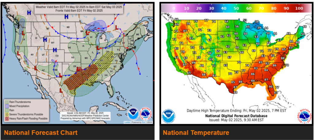
Upper-level omega block to form across the CONUS, leading to periods of unsettled weather and large temperatures contrasts heading into the weekend.
Heavy rain, flooding, and severe weather threats to stretch from the Southern Plains northeast into the Ohio Valley Friday.
The mid- to upper level flow pattern will become increasingly amplified over the next few days with an omega block forming from California, eastward into the Ohio Valley. This pattern will bring periods of unsettled weather first to portions of the eastern and southern U.S., and eventually to the western U.S. heading into the weekend. Southerly flow supporting a moist airmass along a cold front stretching from the Lower Great Lakes southwestward through the Ohio Valley, Middle/Lower Mississippi Valley, and southern Plains will help to focus the first area of showers and thunderstorms.
WYOMING
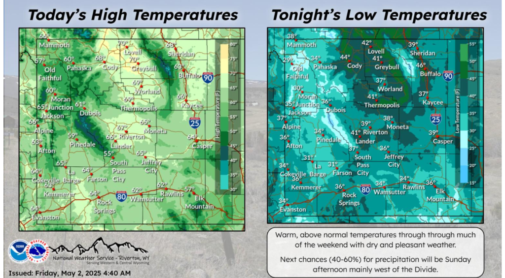
Spring has sprung for the first weekend of May! Warm and dry weather much of the weekend with the next chance of precipitation Sunday afternoon, mainly west of the Divide.
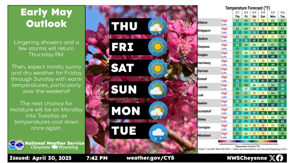
Here’s a look at the forecast into the first week of May! The cool and unsettled pattern will continue for one more day with a few showers/storms expected again Thursday afternoon. After that, the area will dry out and warm up for a few days, with a beautiful, warm spring weekend ahead, although the winds may return on Sunday. The next chance for moisture will be early next week.
NEBRASKA
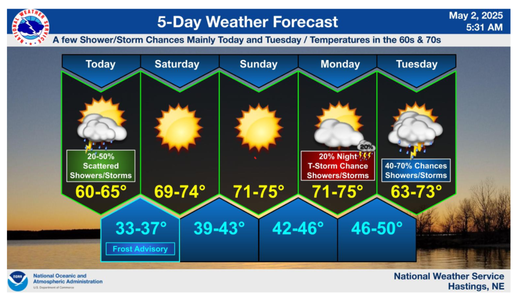
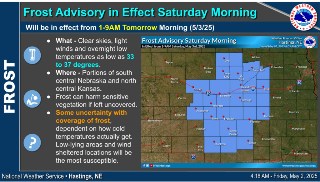
A Frost Advisory will be in effect Saturday morning from 1-9AM as overnight low temperatures approach freezing (33-37 degrees). Though frost coverage remains somewhat uncertain, (places with colder temperatures would see a wider coverage of frost) low-lying and wind sheltered locations would be the most susceptible to the formation of frost.
Have a nice and safe weekend!