
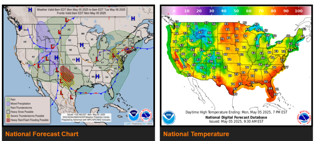
A continued omega block pattern over the Lower 48 will lead to prolonged periods of unsettled weather and cooler temperatures to start the week.
Increasing flash flood threat as well as severe weather expected for the southern Plains/Lower Mississippi Valley Monday into Tuesday.
A blocky pattern remains in place over the Lower 48 to start the week with a slow moving upper-low over the Ohio Valley, another slow moving upper-low over the Southwest, and an upper-level ridge over portions of the northern Plains/Upper Midwest in between.
A more focused heavy rainfall event will develop to the east along portions of the central/southern High Plains, southern Plains, and into the Lower Mississippi Valley over the next couple of days.
WYOMING
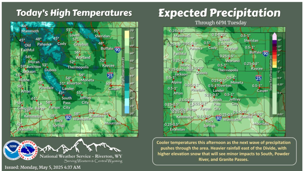
Behind a cold front, expect windy conditions and increasing rain chances this morning before becoming widespread in the afternoon hours. Mountain snow overnight that may make its way to the lower basins for Tuesday morning. Thankful for Spring!
SOUTHWEST
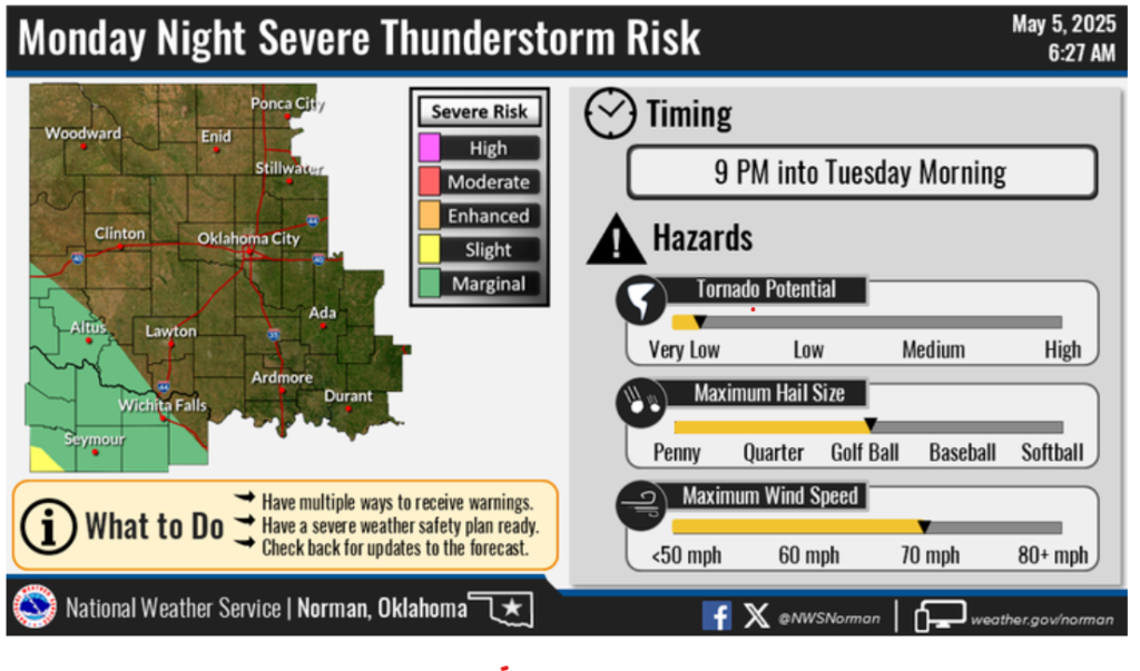
Another round of severe thunderstorms is possible for this afternoon and evening across eastern New Mexico and Oklahoma. Large hail, frequent lightning and damaging wind gusts will be the main threats with these storms. Storms will linger across eastern NM through the overnight hours and may produce heavy rainfall capable of flash flooding.
Have a good and safe day!