
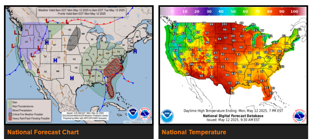
Thunderstorms and heavy rain from the Southeast to the Mid-Atlantic.
Showers and storms in the Northwest; seasonally cool in the East and trending cooler in the West.
Record heat for the Northern and Southern Plains.
A meandering storm system over the Lower Mississippi Valley continues to deliver a blend of both Gulf and Atlantic moisture into the Southeast.
In the West, an incoming storm system will usher in widespread showers (snow for the higher terrain of the Northern Rockies) and much cooler temperatures over the Pacific Northwest today, then throughout the western third of the CONUS by Tuesday. Ahead of the cold front, blustery winds will be common across the Great Basin, the California Peninsular Range, portions of the Mojave Desert, and as far east as northern Arizona.
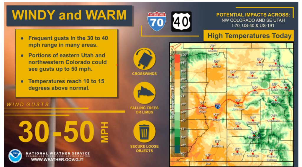
WYOMING

Drier conditions today, as gusty winds return across the area. Temperatures will continue to be well above normal as well. These conditions will combine to lead to elevated fire weather conditions. Any burning is HIGHLY discouraged!
Have a fantastic day!