
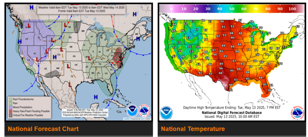
A slow moving upper level low to bring heavy rain and flooding potential to the Mid-Atlantic.
A strong cold front to produce much below average temperatures across large portions of the West Tuesday and Wednesday, as well as scattered thunderstorms and mountain snow.
Summer-like heat to engulf much of the Heartland; Elevated to critical fire weather threats for portions of the Upper Mississippi Valley/Northern Plains and Southwest.
The upper low that has plagued the Southeast with rain and numerous thunderstorms is finally on the move, first tracking through the Mid-South today, then into the Great Lakes by Wednesday. The Mid-Atlantic will be the focus for heavy rainfall through mid-week with the heaviest rainfall unfolding today.
While the West is unusually cool and the East is on the more seasonal side of the temperature spectrum, the Great Plains and Midwest are getting a summer preview.
WYOMING
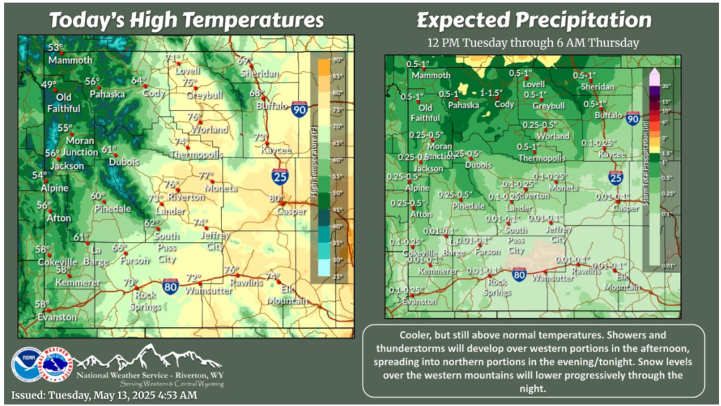
A cold front will progress across the forecast area today. Temperatures will be slightly cooler as a result but will still be above normal. Showers and thunderstorms will develop over western portions this afternoon, shifting to the north through the evening/tonight.
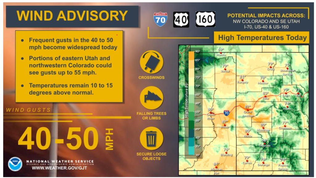
Strong wind gusts will increase in coverage today as a potent upstream system approach. Southerly winds gusting 40 to 50 mph will pose some travel impacts for high profile vehicles moving along east to west roadways. Wind Advisories are in effect for most valley locations from 9AM MDT to 9PM MDT today. Temperatures will remain well above normal but big changes will arrive tomorrow as the upstream system arrives and ushers in much cooler air.
Have a nice and safe day!