
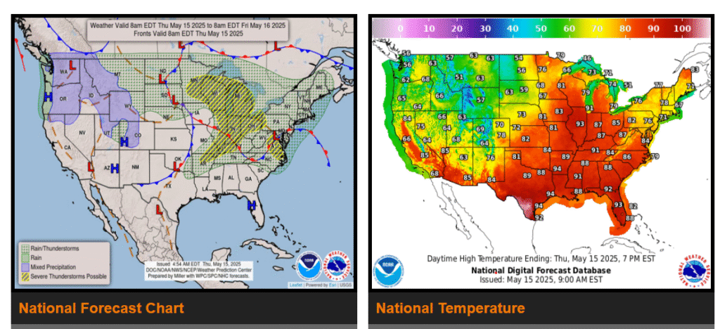
Severe thunderstorms possible for the Middle and Upper Mississippi and Ohio Valleys today and Friday.
Heavy rain and flash flooding possible for portions of the Ohio and Tennessee Valleys on Friday.
Dangerous heat forecast for portions of Texas.
A strong low pressure system will track into the Upper Midwest today, supporting active weather for the Mississippi and Ohio Valleys and Great Lakes region today and Friday.
Widespread showers and thunderstorms are forecast ahead of a strong cold front that will push east across these regions, and conditions will be favorable for severe thunderstorm development. Today, the highest severe thunderstorm threat will extend from the Upper Mississippi Valley to the Great Lakes, then the highest threat will shift to the Ohio and Middle Mississippi Valleys on Friday.
WYOMING
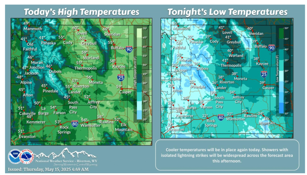
Temperatures will remain on the cool side today as northwest flow aloft continues. Showers will be widespread this afternoon and ending in the evening. Isolated lightning strikes will be possible with some of the showers.
Expect another round of scattered rain showers and isolated thunderstorms Thursday afternoon but slightly less coverage as previous days. Even less expected for Friday as well and more constrained to northern parts of the state.
NEBRASKA
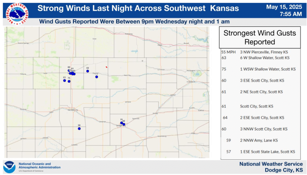
Strong gusty northwest winds occurred across southwest Kansas last night. Wind gusts of 60 to 75 mph were reported. These strong winds created reduced visibility due to blown dust. Did you get strong winds in your area? We would like to know. Please include estimated wind speed (if possible), any wind damage and time.
Have a good and safe day!