
Severe thunderstorm outbreak expected today across the mid-Mississippi, Tennessee and Ohio Valleys, along with the potential for heavy rain and flash flooding.
Multiple rounds of thunderstorms and heavy rain over the next few days could lead to isolated flash flooding across portions of New England.
Record-breaking heat forecast across South Texas, the Gulf Coast, and Southeast through early this weekend as highs soar into the upper 90s and triple digits.
Windy and cool conditions anticipated across the Northern Plains today, as well as the Intermountain West and Rockies this weekend.
A very active and complex mid-May weather pattern is set to produce numerous areas of severe weather, heavy rain, high winds, and anomalous temperatures through this weekend. A waffling frontal boundary stretching from the mid-Mississippi Valley to the mid-Atlantic is expected to become the focus for a potentially damaging severe weather outbreak today as a sweeping secondary cold front pushes eastward out of the Great Plains tonight. Blossoming severe thunderstorms will be capable of containing large hail, damaging winds, and tornadoes between southeast Missouri and West Virginia, with thunderstorms containing damaging winds also possible across a larger area extending from northeast Texas to the mid-Atlantic. The Storm Prediction Center has issued a Moderate Risk (level 4/5) for severe weather centered over the Lower Ohio Valley, where the greatest concerns exist for several strong tornadoes.

WYOMING
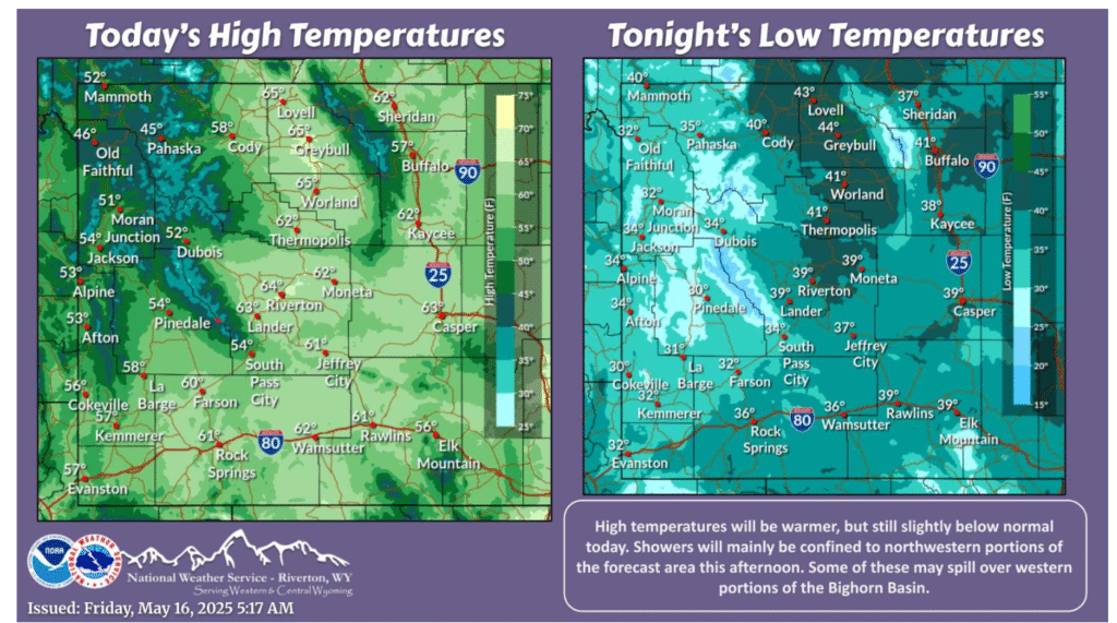
Temperatures will be warmer, but still slightly below normal. Showers will be possible over northwestern portions this afternoon, ending by sunset. Otherwise, conditions will be dry. Showers and thunderstorms will be more widespread Saturday, with strong storms possible over southwestern portions.
As shower/storm activity winds down this evening, a bit of a lull for Friday and Saturday before the next system for Sunday and Monday. Exact details of amounts are not of high certainty at this point in time but another widespread system is expected that will help continue to put in a dent to the drought.
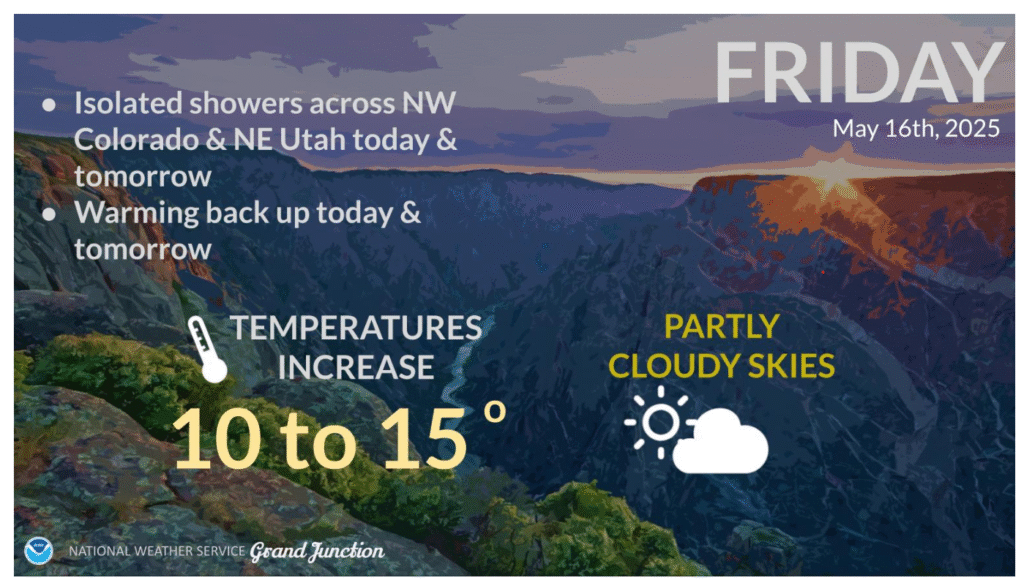
Temperatures recover today by nearly 10 degrees across the region. A weak frontal boundary across northeast Utah and northwest Colorado could produce an isolated shower this afternoon. However, most of the CWA will remain dry today under partly cloudy skies and westerly winds 10 to 15 mph.
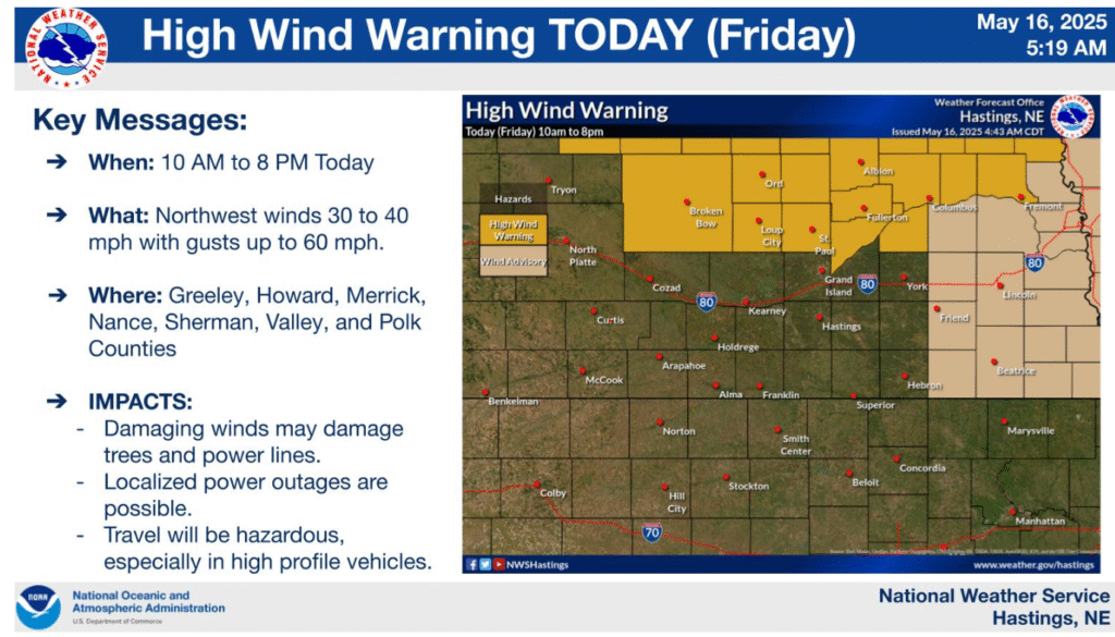
A High Wind Warning is in effect from 10am to 8pm today. Wind gusts up to 60 MPH are possible in the highlighted area. Gusts from 40-55 MPH are expected for the rest of the area.
Let’s have a great and safe weekend!