
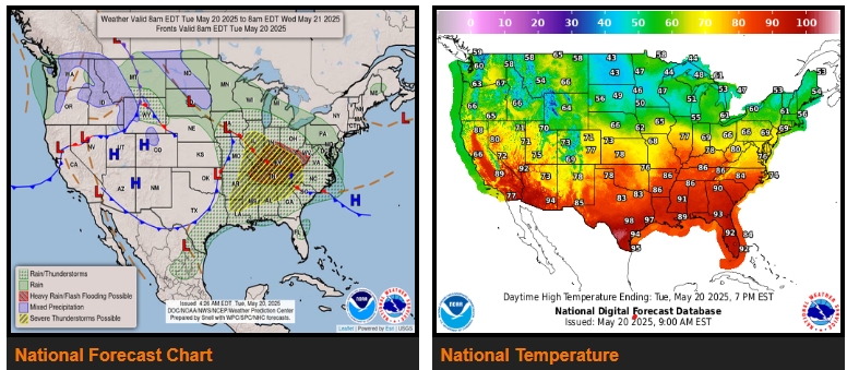
Severe Weather and Flash Flooding risks shift into the Ohio/Tennessee/Mississippi Valleys today, followed by the East Coast on Wednesday.
Above average temperatures across southern tier states; below average temperatures across the northern tier.
A strong low pressure system will spread scattered showers and thunderstorms across the Mississippi Valley today, then the Ohio Valley/East Coast on Wednesday.
WYOMING
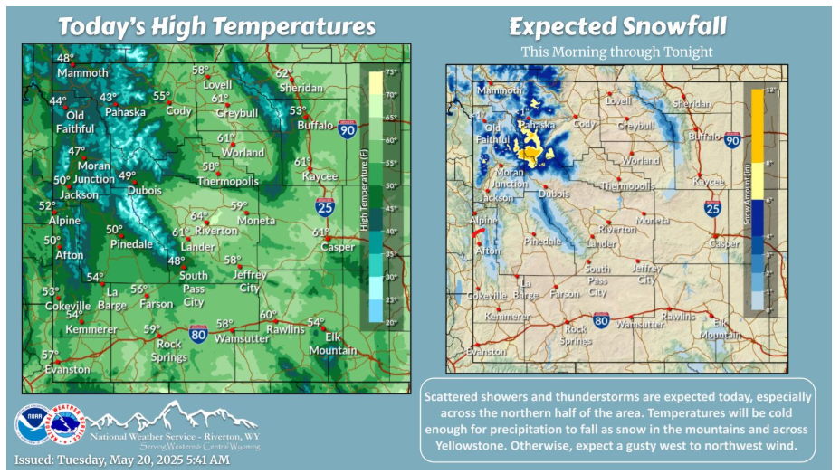
Scattered showers and thunderstorms are expected today, especially across the northern half of the area. Temperatures will be cold enough for precipitation to fall as snow in the mountains and across Yellowstone. Otherwise, expect a gusty west to northwest wind. Warmer and drier conditions return Wednesday, though an unsettled pattern will keep isolated shower and thunderstorm chances going for much of the area through the end of the week.
NEBRASKA
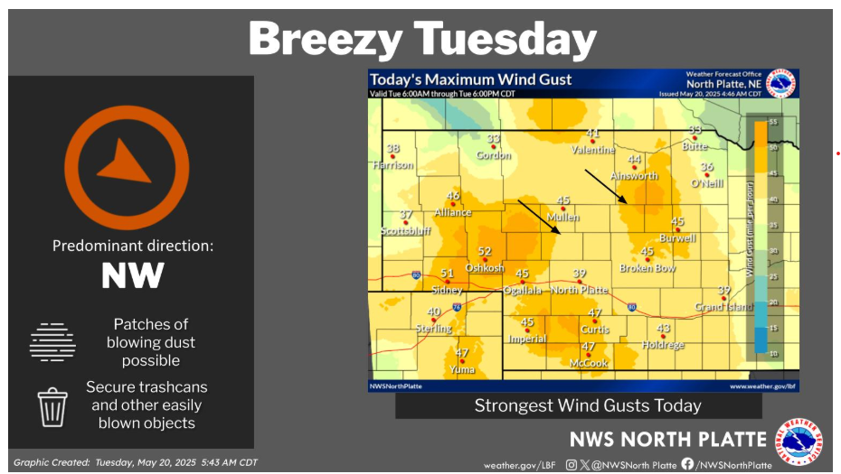
Strong northwest winds today with sustained winds around 30 to 35 mph and gust of 40 to 50 mph. Secure any loose items and use caution when driving high profile vehicles. There may also be areas of patchy blowing dust.
Have a good and safe day.