
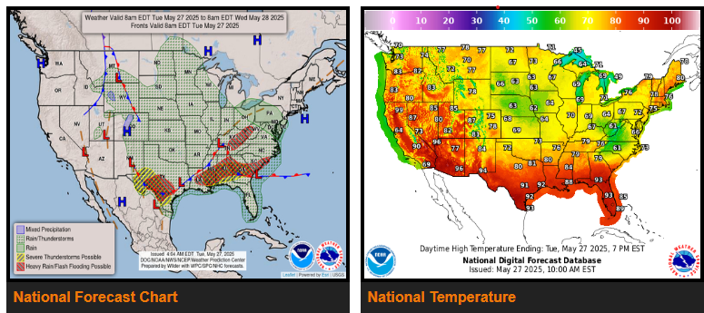
There is a Slight Risk of excessive rainfall over parts of the Southern Plains, the Lower Mississippi/Tennessee Valleys/Southeast/southern Mid-Atlantic, and Ohio Valley/Central Appalachians on Tuesday.
There is a Slight Risk of severe thunderstorms over parts of the Southern Plains and Lower Mississippi Valley/Southeast on Tuesday and the Southern High Plains on Wednesday.
A wave of low pressure over the Tennessee Valley will move to the Lower Great Lakes by Thursday. One more day of moisture will flow northward out of the Gulf of America and overrun the boundary, creating showers and thunderstorms with heavy rain over parts of the Southern Plains.
Moreover, a second area of heavy rain will develop over parts of the Lower Mississippi Valley to the Southeast and southern Mid-Atlantic.
A second wave of low pressure will also move southeastward out of the Texas Panhandle to the Central Gulf Coast by Thursday morning. The system will produce showers and severe thunderstorms over Southern High Plains.
WYOMING
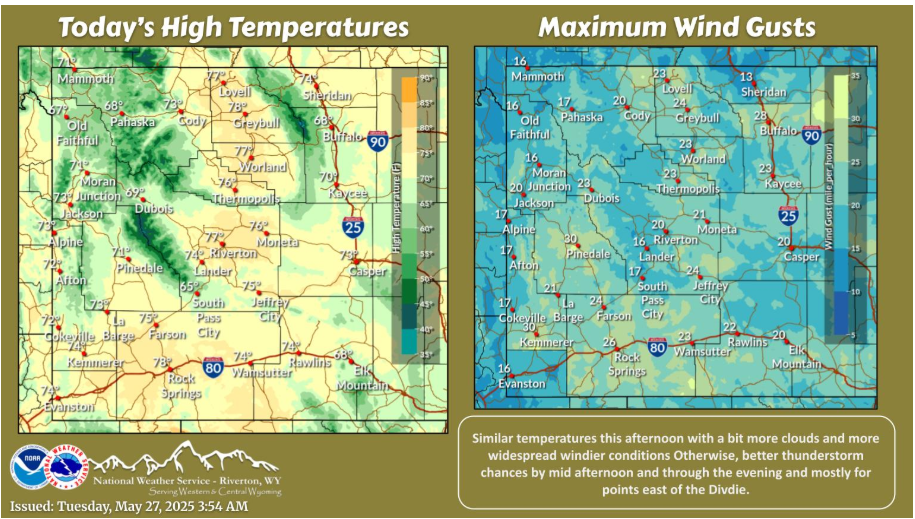
Warm again this afternoon with a bit stronger winds and increased cloud cover. Bette storm chances east of the Divide as well and more widespread by 2-3PM and through the evening hours.
COLORADO
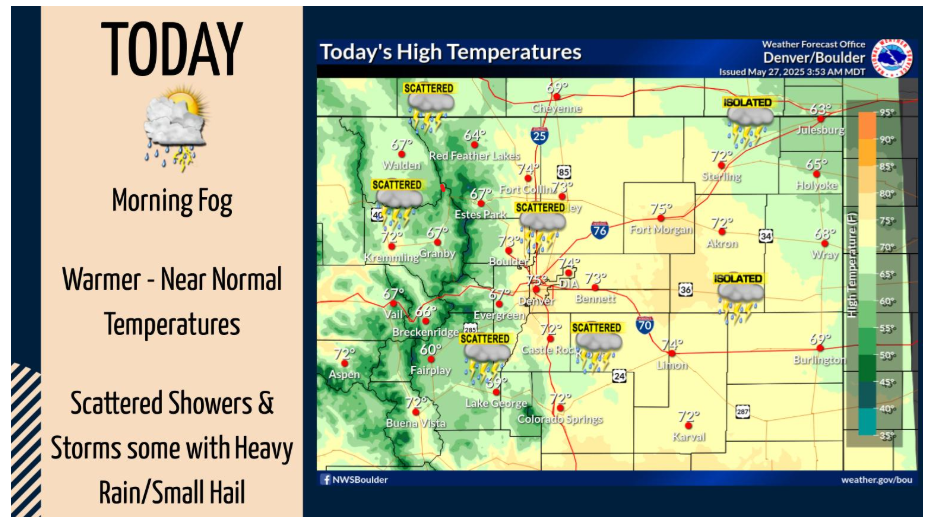
After morning fog and low clouds, mostly sunny skies will lead to warmer temperatures today. Scattered showers and thunderstorms are expected this afternoon and evening, some containing heavy rain and small hail.
OKLAHOMA
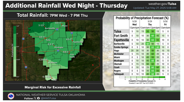
Another round of rainfall is forecast for eastern Oklahoma and northwest Arkansas Wednesday night and Thursday. Rainfall will not be as intense as the past few days, but a marginal risk for excessive rainfall will still develop. Localized flash flooding will be possible, especially considering recent rain totals across the area.
Let’s drive safe and have a fantastic day!