
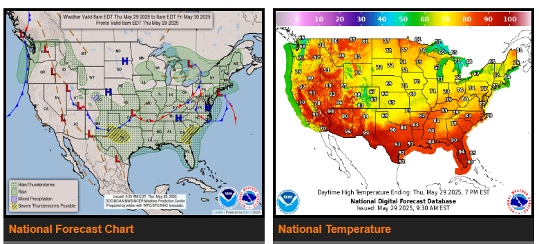
There is a Slight Risk of excessive rainfall over parts of the Mid-Atlantic, Central Appalachians, and Ohio Valley on Friday.
There is a Slight Risk of severe thunderstorms over parts of the Southern Plains and the Southeast on Thursday and the Southeast to the Mid-Atlantic on Friday.
An upper-level low over the Central Plains/Middle Mississippi Valley will trigger showers and thunderstorms over parts of the Central Plains/Middle Mississippi Valley and Ohio/Tennessee Valleys. On Thursday, showers and thunderstorms will develop over the Central Rockies.
On Friday, as the third wave of low pressure over the Ohio Valley moves into the Mid-Atlantic, showers and thunderstorms will develop with heavy rain over parts of the Ohio Valley, Central Appalachians, and Mid-Atlantic.
WYOMING
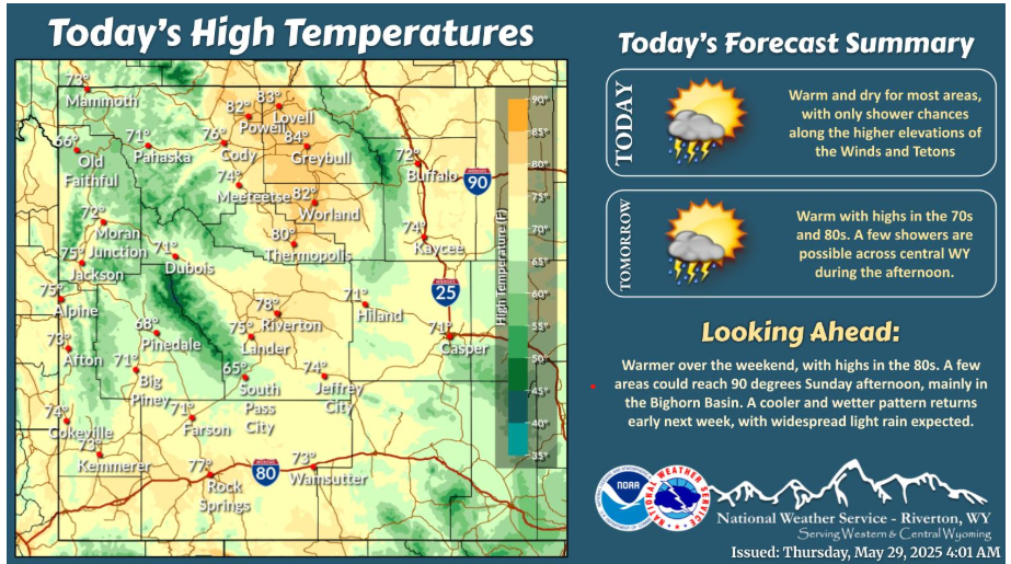
Warm and dry conditions continue today, with highs in the 70s and 80s. Showers will be limited to higher elevations of the Winds and Tetons this afternoon. Warm and dry conditions continue into the weekend.
Temperatures across many locations will climb into the upper 80s and low 90s this weekend, with the warmest day being Sunday. As a result, increased mountain snowmelt is expected and could lead to increased flows in local streams and rivers. If you encounter flooding, please report it to your local law enforcement and stay away from high fast-moving water.
Have a nice and safe day!