
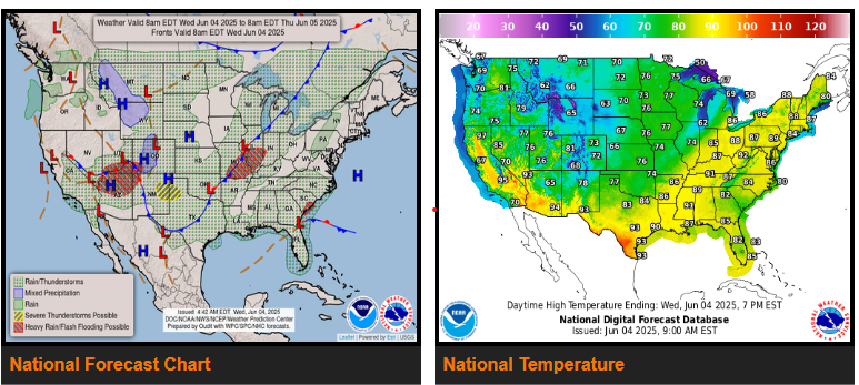
Heavy rain and severe thunderstorms across the Southern Plains weaken today but the next round of moderate to heavy rain is expected to impact the south-central U.S. beginning Thursday night.
Heavy showers and thunderstorms, as well as the potential for scattered flash flooding, are expected across the Four Corners into the central/southern High Plains.
Tropical moisture across South Florida is forecast to spread further up the Florida Peninsula and into the coastal Southeast.
A cold front extending from Texas through the Great Lakes has been the focus of widespread strong to severe thunderstorms marching eastward across the mid-section of the country.
Meanwhile, tropical moisture that has already brought heavy rain across South Florida in the vicinity of a stalled front will continue to interact with an upper-level trough over the northeastern Gulf.
Behind a cold front sagging southward across the Plains, temperatures will be around 10-20 degrees below average for early June. Temperatures in the 60s and 70s will be commonplace for the heart of the nation. While temperatures cool across the mid-section of the country, the opposite will occur along the East coast.
WYOMING
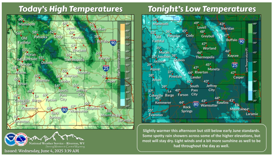
Today will be the start of a slow warming trend through the rest of the work week and into the weekend. Light winds, more ample sunshine, and isolated rain showers can be had through the daylight hours.
May was warmer and mainly drier than normal. A couple of fronts and several days with widespread showers brought the moisture. The month started and ended with very warm days.
NEBRASKA

Cool conditions continue through the end of the week with highs only in the 60s to low 70s. Rain and isolated thunderstorm chances also continue into Friday, although, the severe risk remains low.
KANSAS
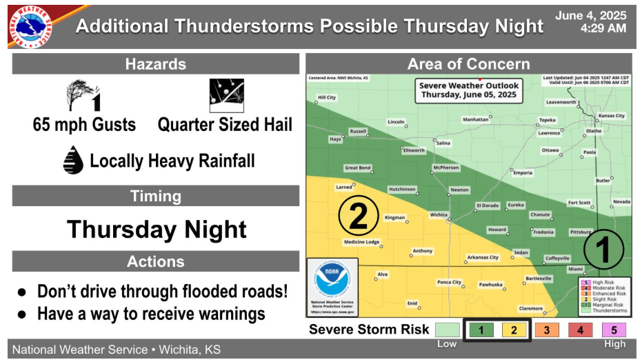
Another round of thunderstorms could impact the region Thursday night, with the highest chances from western into southern Kansas. A handful of strong to severe storms are possible, along with locally heavy rainfall, which could aggravate ongoing flooding concerns.
Temperatures will gradually warm this week, with a few light showers possible late tonight into Thursday morning. Thunderstorm chances look to increase Thursday night, mainly over southern Kansas.
Have a fantastic Day!