
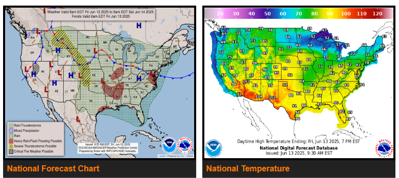
Heavy to Excessive Rainfall likely across portions of the east-central U.S. over the next couple of days.
Heatwave expected for the Desert Southwest with highs reaching the 110s by this weekend.
The main thing making weather headlines Friday and into the weekend will be the widespread coverage of showers and thunderstorms across much of the central and eastern U.S., with a particular focus across southeast Texas, the Mid-South, and portions of Virginia.
Another area of moderate to heavy rainfall is also expected across portions of the Upper Midwest, mainly over central Minnesota through midday Friday where 1 to 2 inches is currently forecast.
It will continue to be quite warm and dry Friday and into the weekend across much of the interior Western U.S. as an upper level ridge governs the overall weather pattern. The most impactful heat will be across the lower elevations of the Desert Southwest where afternoon highs will reach 105 to 110 degrees through Friday, and then reaching the 110s over the weekend.
WYOMING
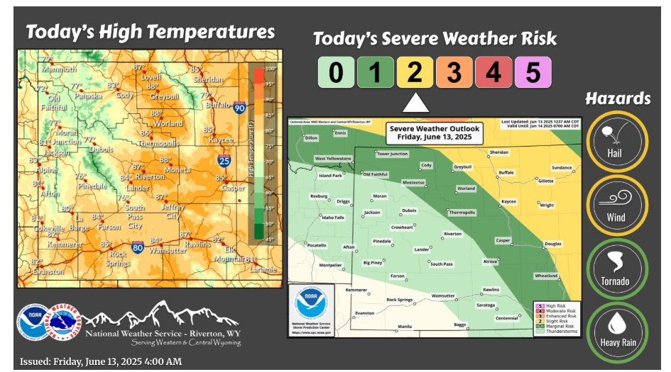
Showers and thunderstorms will be possible today across most of the area. Some of these storms could produce strong winds and hail, especially around Johnson County where the greatest severe weather potential is.
NEBRASKA
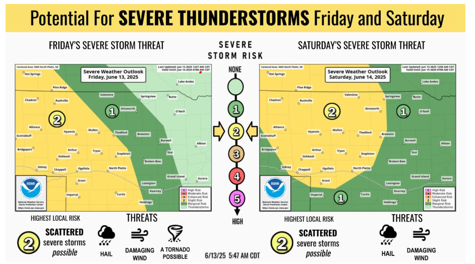
Heads up for late-week storm chances! Scattered severe thunderstorms are likely Friday and possible Saturday, especially across western and central Nebraska. Damaging wind and hail are the primary threats, with a tornado or two not out of the question on Friday.
Stay weather aware!
Have a fantastic weekend.