
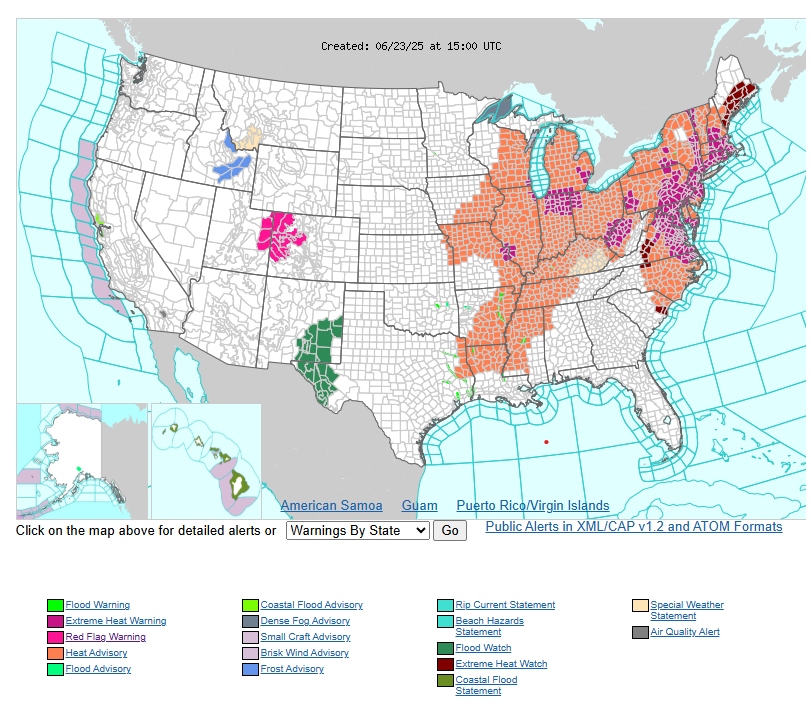
Extremely dangerous heat persists from Midwest to the East Coast this week.
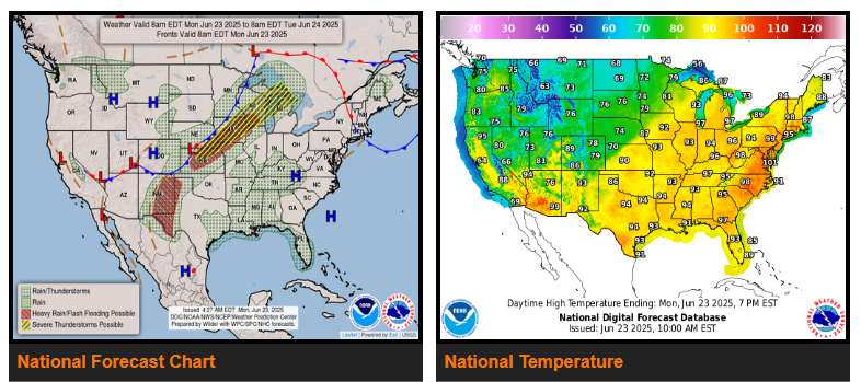
Excessive Rainfall and Severe Weather concerns across portions of the Central U.S.
A strong upper-level ridge parked over the eastern half of the country will continue to generate an extremely dangerous heat wave this week. Extreme HeatRisk impacts will expand from the Midwest into the Mid-Atlantic today.
High temperatures in the 90s to 100s and lows in the 70s to low 80s will break numerous records over the next several days. Dense urban centers like: Columbus, OH; Washington, DC; and Philadelphia, PA will experience especially significant heat impacts.
Elsewhere, a slow moving upper trough and quasi-stationary surface fronts will produce rounds of thunderstorms across the Central U.S. over the next few days. SPC issued a slight risk (level 2/5) of severe thunderstorms for a swath extending from northern Kansas to northern Michigan/the U.P. today followed by another slight risk over the Front Range on Tuesday.
There’s a slight risk of excessive rainfall over parts of eastern New Mexico and western Texas where a couple inches of rain could fall. Conditions worsen while moisture anomalies increase and shift westward a bit on Tuesday. Afternoon/evening storms could produce several inches of rain over much of New Mexico and into southern Colorado.
WYOMING
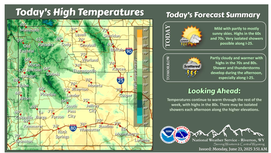
Milder conditions today, with highs in the 60s and 70s. A few showers are possible along the I-25 corridor. Temperatures continue to warm the rest of the week, with some strong thunderstorms possible across central WY on Tuesday.
Have a fantastic day!