
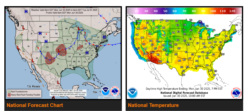
There is a Slight Risk of excessive rainfall over parts of the Central/Southern Plains and Southern Rockies/Southern High Plains on Monday and the Mid-Atlantic on Tuesday.
There is a Slight Risk of severe thunderstorms over parts of the Mid-Atlantic on Tuesday.
Showers and strong to severe thunderstorms will develop along and ahead of the boundary over parts of the Great Lakes/Ohio Valley and Middle Mississippi Valley into the Southern Plains. In addition, the showers and thunderstorms will produce heavy rain over parts of the Central/Southern Plains.
South and east of the front, upper-level impulses, daytime heating, and moisture will create showers and thunderstorms over the Ohio/Tennessee Valleys, Southern Plains, Lower Mississippi Valley, and the Southeast.
The showers and thunderstorms will also produce heavy rain over parts of the Mid-Atlantic. Therefore, the WPC has issued a Slight Risk (level 2/4) of excessive rainfall over parts of the Mid-Atlantic from Tuesday through Wednesday morning.
NEBRASKA
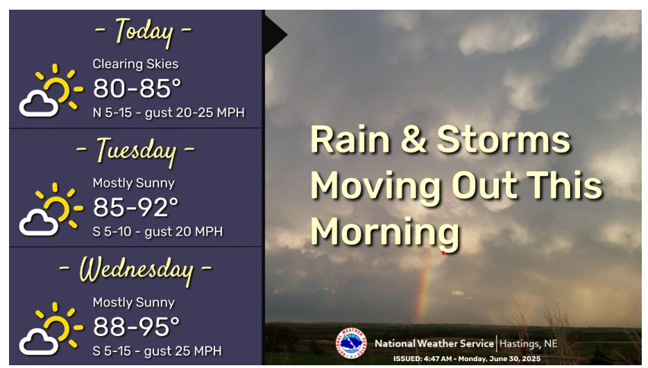
Rain and storms will move out of the area this morning. Mostly dry conditions are expected for the rest of today through Wednesday with the exception of a slight chance (15% to 25%) of showers and storms Tuesday evening and night. High temperatures today will be in the 80s and will warm up to the 80s & 90s Tuesday & Wednesday.
Let’s have a great day!