
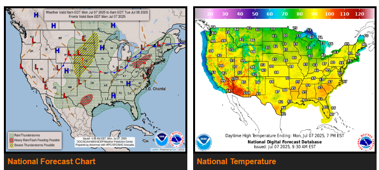
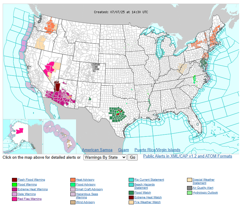
More slow-moving thunderstorms will lead to another day of localized flash flooding threat in central Texas.
Tropical Depression Chantal is forecast to track through the Mid-Atlantic states today with a period of heavy rain before brushing the southern New England coast tonight into Tuesday morning.
A round of strong to severe thunderstorms expected to impact the northern Plains and central High Plains later today and tonight.
Heat and humidity will affect much of the East Coast for the next couple of days as heat intensifies across the Northwest and Desert Southwest.
Hot and muggy weather is expected to settle across much of the East Coast and South during the next couple of days ahead of the slow-moving front and tropical moisture from Chantal moving into the mid-Atlantic. Widespread Moderate to Major Heat Risk is in place throughout the region, including many of the regions large population centers, indicating a level of heat that can affect anyone without effective cooling or hydration, especially those groups more sensitive to heat. Progression of the cold front southward will bring some relief of the heat into the Ohio Valley by Tuesday.
WYOMING
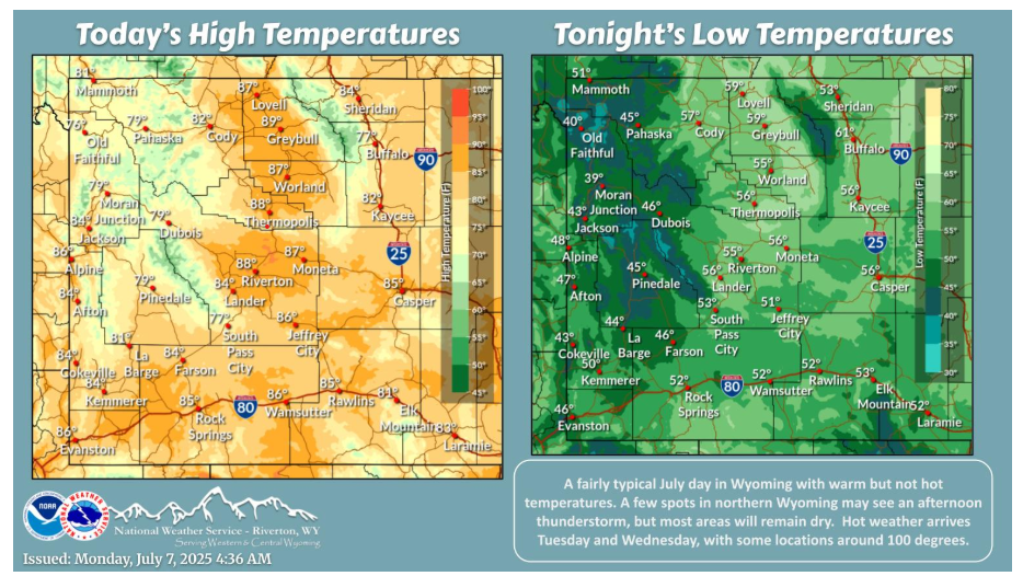
Mainly dry for most today with temperatures near to slightly above normal. Any isolated thunderstorms would be across northern Wyoming. Turning hotter Tuesday and Wednesday with some spots near 100.
NEBRASKA
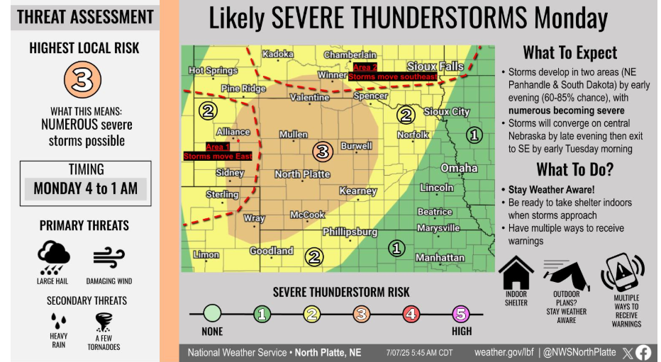
Severe storms are likely late this afternoon through tonight across much of western and central Nebraska. A Level 3 (Enhanced Risk) is in place, with storms expected to develop by early evening across the NE Panhandle and South Dakota before moving into central Nebraska. Main hazards include large hail and damaging winds, with heavy rain and a few tornadoes also possible. Be weather aware and have multiple ways to receive warnings.
Have a fantastic day!
“What you get by achieving your goals is not as important as what you become by achieving your goals.” -Zig Ziglar