
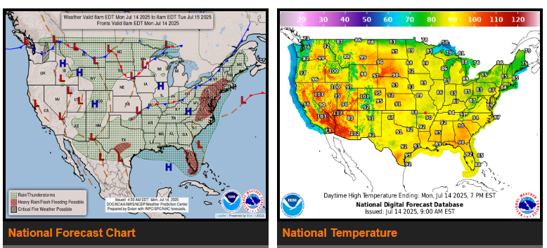
Widespread heavy rainfall with the potential for numerous instances of flash flooding along the I-95 corridor in the Mid-Atlantic Monday.
Heavy rainfall and flash flood threat for Florida Monday-Tuesday.
Increasing thunderstorm chances across portions of the north-central U.S. with flash flooding and severe weather expected Tuesday.
Uncomfortable heat remains in place across much of the eastern and western U.S.
Thunderstorms with very heavy rainfall are also expected over portions of the central and southern Florida Peninsula where the National Hurricane Center is monitoring a trough of low pressure along the Atlantic Coast, expected to move westward into the Gulf over the next couple of days.
WYOMING
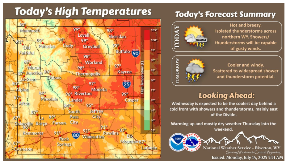
Another hot and breezy day is in store. Isolated shower and thunderstorm potential exists across northern WY. Most showers/thunderstorms will be dry but capable of gusty winds around 50 mph. Cooler Tuesday and Wednesday with more scattered to widespread shower and thunderstorm potential.
Have a fantastic day.
“You simply have to put one foot in front of the other and keep going. Put blinders on and plow right ahead.” – George Lucas