
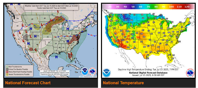
A moisture-rich Summer-time airmass over much of the eastern/central U.S. will continue to lead to areas of scattered to widespread thunderstorms capable of heavy downpours and flash flooding. A lingering frontal boundary across the Mid-Atlantic/Appalachians west into the Ohio Valley will be one such focus area the next couple of days with moisture values near climatological maximums leading to very heavy downpours/high rain rates.
A potent upper-level short-wave and accompanying surface cold front will be another focus area for widespread thunderstorms across the north-central U.S. On Tuesday, the front will stretch from the Upper Great Lakes southwest into the Upper Missouri Valley, with plentiful moisture and the possibility of repeated rounds/training thunderstorms moving parallel to the front leading to scattered flash flooding, with a Slight Risk in place.
Lingering thunderstorms associated with a convective complex over sensitive areas of central Texas will continue to bring the threat of scattered flash flooding into Tuesday with a Slight Risk in place. Scattered Monsoonal thunderstorms chances remain in the forecast into mid-week across portions of the Southwest/Four Corners Region.
The moisture-rich airmass over the East will bring increasingly uncomfortable conditions as temperatures steadily warm into 90s over the next couple of days. Areas of Major Heat Risk (level 3/4) increase in coverage from Tuesday into Wednesday across the Southeast and especially into the Northeast, indicating a level of heat dangerous to anyone without adequate air conditioning or hydration.
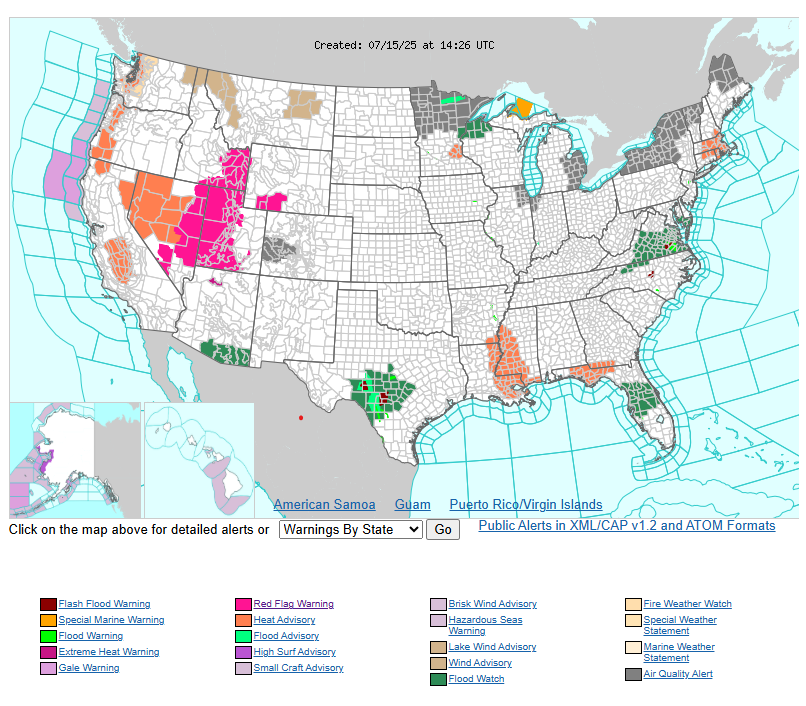
In the West, hotter temperatures and heat-related advisories remain in effect for portions of the central California Valleys and western Great Basin Tuesday as temperatures rise into the upper 90s to low 100s, before a bit of relief comes Wednesday.
WYOMING
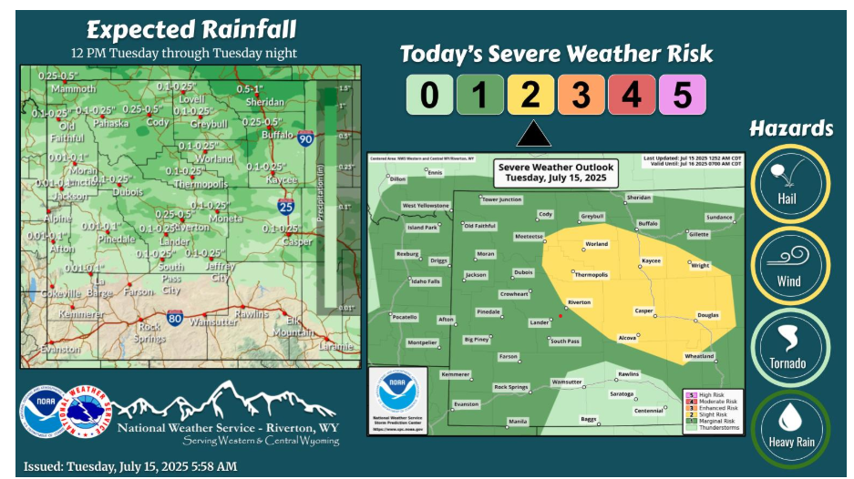
A cold front has moved through areas east of the Divide this morning. Showers and thunderstorms is expected across the forecast area this afternoon and evening. Strong wind gusts up to 60 mph, large hail and locally heavy rain will be the main threats with storms east of the Divide. A Red Flag Warning is also in effect for most of Sweetwater County this afternoon and evening.
NEBRASKA
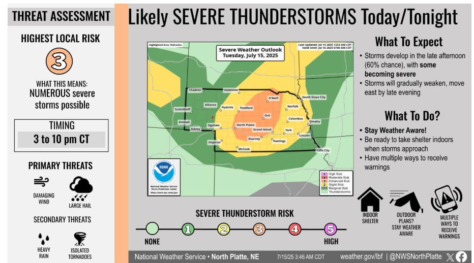
Severe storms are likely later this afternoon into the evening hours. The main severe threat is damaging wind gusts. Secondary hazards include, large hail, heavy rain and a tornado or two.
Have a fantastic day!
“The will to succeed is important, but what’s more important is the will to prepare.” – Bobby Knight