
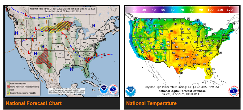
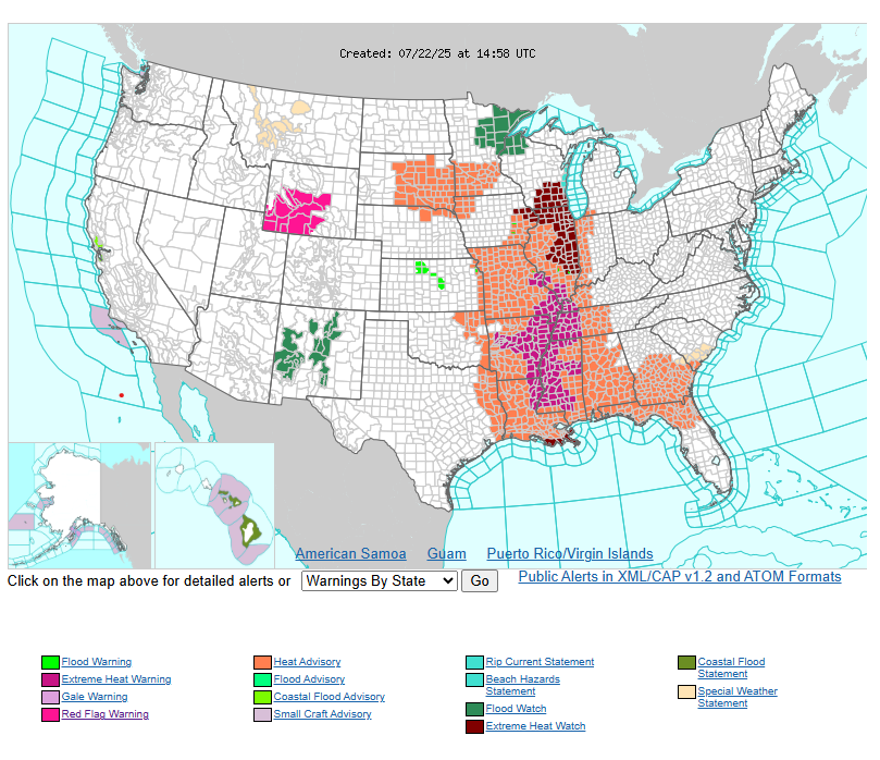
The “Dog Days of Summer” are in full swing for most of the eastern two-thirds of the country as a strengthening heat dome over the Mississippi and Ohio Valleys gradually builds over the eastern U.S. by the second half of the week. Temperatures soaring into the upper 90s will be high enough to set some localized daily records in the Southeast for late July. In addition, overnight/morning low temperatures dropping only into the mid to upper 70s will break a greater number of warm minimum temperature records. Heat indices from the Central Plains to the Southeast will range between 100-110F each day with localized readings potentially reaching 115F.
Precipitation across the continental U.S. continues to be heavily influenced by a so-called “Ring of Fire” weather pattern; an upper-level ridge pattern over the southeastern U.S. circulating a series of disturbances across the northern and southern tiers of the U.S. This ridge of high pressure is channeling rich Gulf moisture north into the Upper Midwest ahead of an approaching cold front. Farther east, high pressure over the Northeast is pushing a cold front down the East Coast with low pressure lingering over the Southeast. WPC maintains a pair of Slight Risks (threat level 2/4) for flash flooding in portions of the Upper Midwest and the Southwest.
Elsewhere, regions expecting cooler than normal temperatures and a more tranquil weather pattern to start the week are the Desert Southwest and Northeast. The Northeast will witness unusually cool and comfortable temperatures for late July with some communities struggling to get above 80 degrees today.
WYOMING
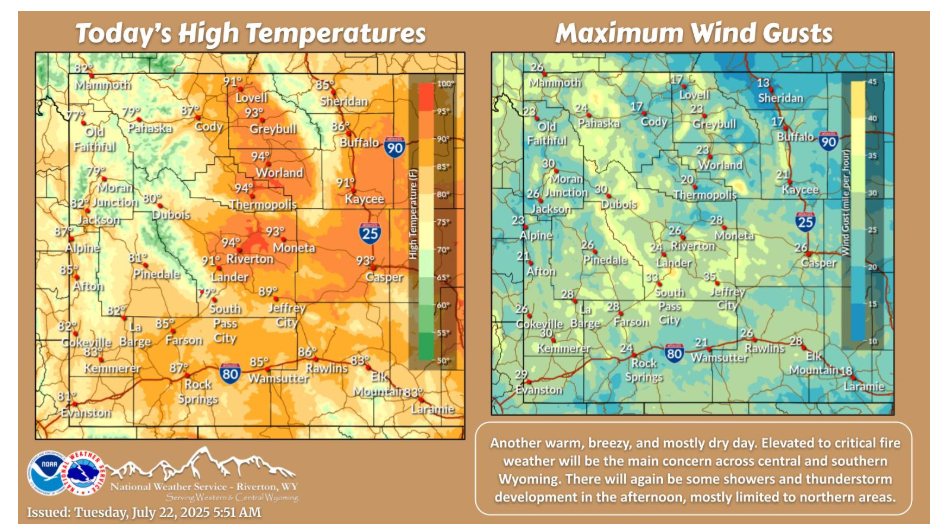
Another warm, breezy, and mostly dry day. Elevated to critical fire weather will be the main concern across central and southern Wyoming. There will again be some showers and thunderstorm development in the afternoon, mostly limited to northern areas.
Have a fantastic day!
“It always seems impossible until it’s done.” -Nelson Mandela