
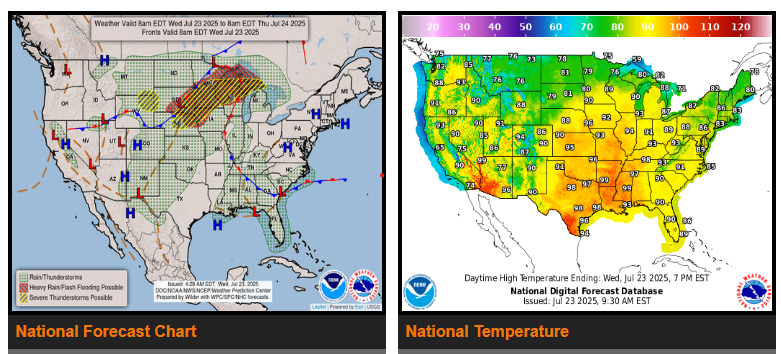
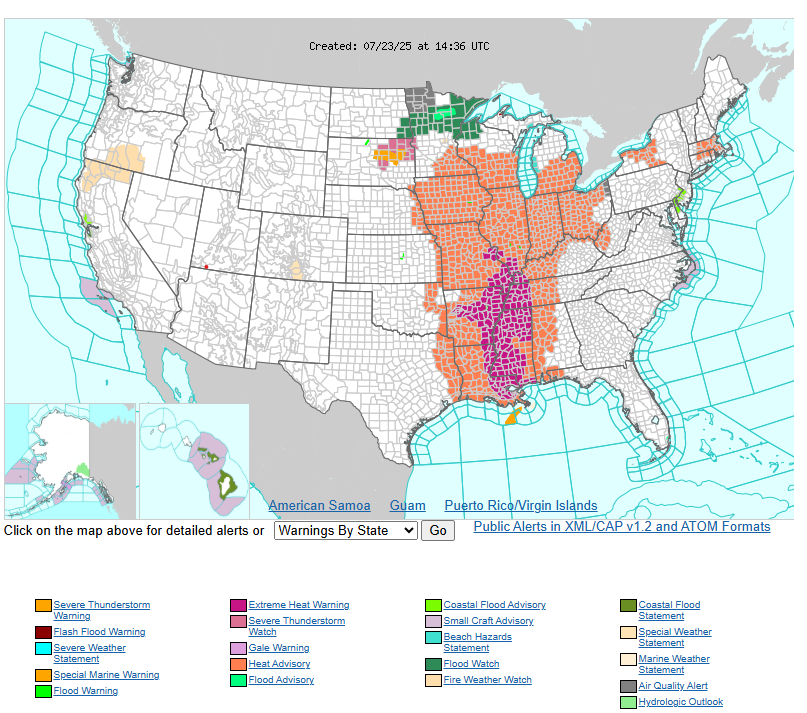
The remainder of the week features a strengthening heat dome over the Mississippi Valley today that gradually builds east towards the East Coast by week’s end. A combination of mid-upper 90s for high temperatures and humid conditions are a recipe for oppressive heat indices that range between 100-115F for many areas along and just east of the Mississippi River today.
Record heat in parts of these regions are also expected, with the bulk of the record warmth coming via the overnight/morning lows as temperatures drop only into the mid-upper 70s. The NWS HeatRisk product depicts Major Impacts, and even localized Extreme Impacts, from as far south as the central Gulf Coast to as far north as northern Wisconsin.
As the heat ridge orients itself over the Mississippi Valley today, copious amounts of moisture over the Southern Plains will stream northward into the Midwest today. This moisture source will be directed at an approaching frontal boundary and trigger widespread showers and storms from the Central Rockies to the northern Great Lakes. There are Slight Risks issued from both the Weather Prediction Center (WPC) and Storm Prediction Center (SPC) as widespread storms across the Midwest pose a threat for both flash flooding and severe weather today.
In the West, temperatures will largely be on the unseasonably cool side thanks to a meandering cut-off upper low meandering off the California coast through Thursday night. The upper low will also act as a trigger for showers and thunderstorms in pats of northern California on Thursday, particularly in the Shasta and Sierra Nevada mountain ranges.
WYOMING
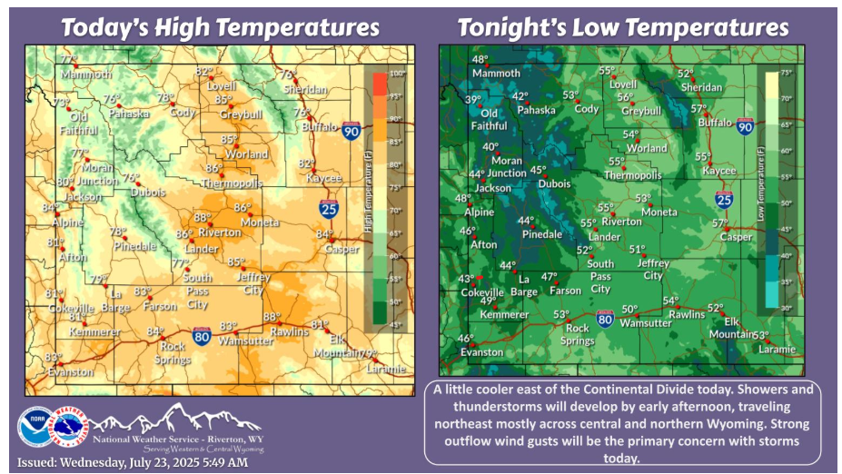
A little cooler east of the Continental Divide today. Showers and thunderstorms will develop by early afternoon, moving northeast mostly across central and northern Wyoming. Strong outflow wind gusts will be the primary concern with storms today.
NEBRASKA
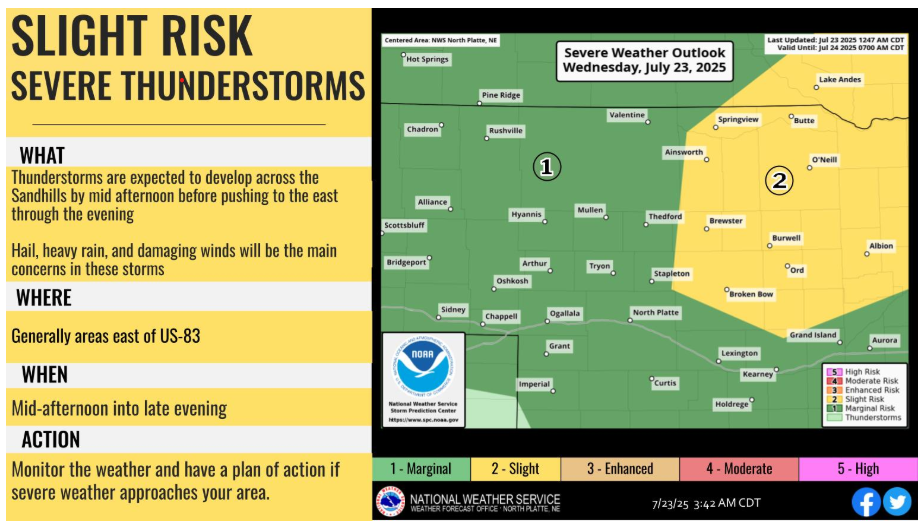
A slight risk (level 2 of 5) of severe thunderstorms is possible today for areas mainly east of US-83. Hail, heavy rainfall, and damaging winds will be the main threats. Storms come to an end by mid to late evening.
Have a fantastic day!