
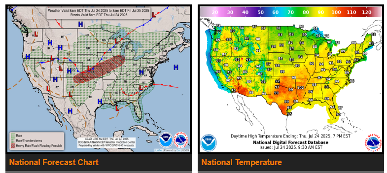
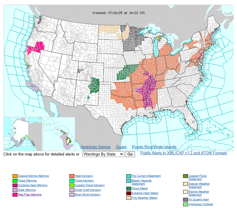
A late July heat wave will continue to expand eastwards during the second half of the week with sultry conditions on tap from the Lower Mississippi Valley and Midwest to the Northeast and Mid-Atlantic. This is due to upper-level high pressure anchoring itself over the eastern U.S. that is acting as a heat dome over the eastern third of the Lower 48.
As the upper-level ridge of high pressure causes sizzling heat in the East, it will also help to usher in copious amounts of Gulf moisture northward across the Front Range of the Rockies, the Central Plains, and Midwest today. In addition, a cold front approaching from the Northern Plains will help ignite widespread thunderstorms across much of the Nation’s Heartland and in to the Great Lakes.
n the South, a wave of low pressure moving west along the Gulf Coast containing tropical moisture aloft will spawn additional heavy showers and thunderstorms from the central Gulf Coast on east through much of Florida today. The heavy rain potential continues to march west towards the Texas Coast on Friday with additional downpours likely along the Gulf Coast.
While the majority of the West is likely to experience dry and seasonally cool conditions, the exception to the dry conditions is northern California on east into the northern Great Basin. Dry thunderstorms are a growing concern in the northern Sierra Nevada and into the northern Great Basin where critically dry fuels are present and lightning strikes could spark wildfires in these regions today.
WYOMING
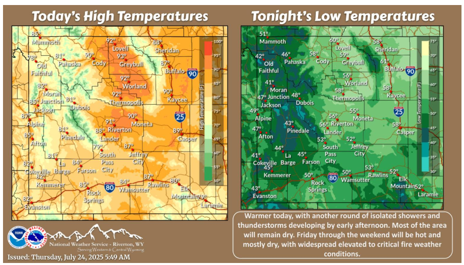
Warmer today, with another round of isolated showers and thunderstorms developing by early afternoon. Most of the area will remain dry. Friday through the weekend will be hot and mostly dry, with widespread elevated to critical fire weather conditions.
Have a fantastic day.