
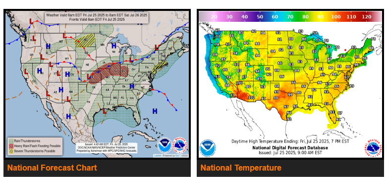
A slow moving surface front beneath a quick moving shortwave impulse will produce thunderstorm activity from the Central Plains to the Northeast, within a moisture rich environment today. Storms occurring over relatively saturated soils may pose a flash flooding threat, which is why a slight risk (at least 15% chance) of excessive rainfall is in effect for portions of eastern Kansas, northern Missouri, southern Iowa, Illinois and Indiana.
Today will be the last day of widespread heavy rainfall across the Gulf Coast. Troughing along the coast has offered a lifting mechanism for storm development/organization over the last few days, but should wind down as an upper ridge in the vicinity strengthens. 1-3 additional inches of rain are anticipated from the Florida panhandle to the central Texas coast by Sunday morning.
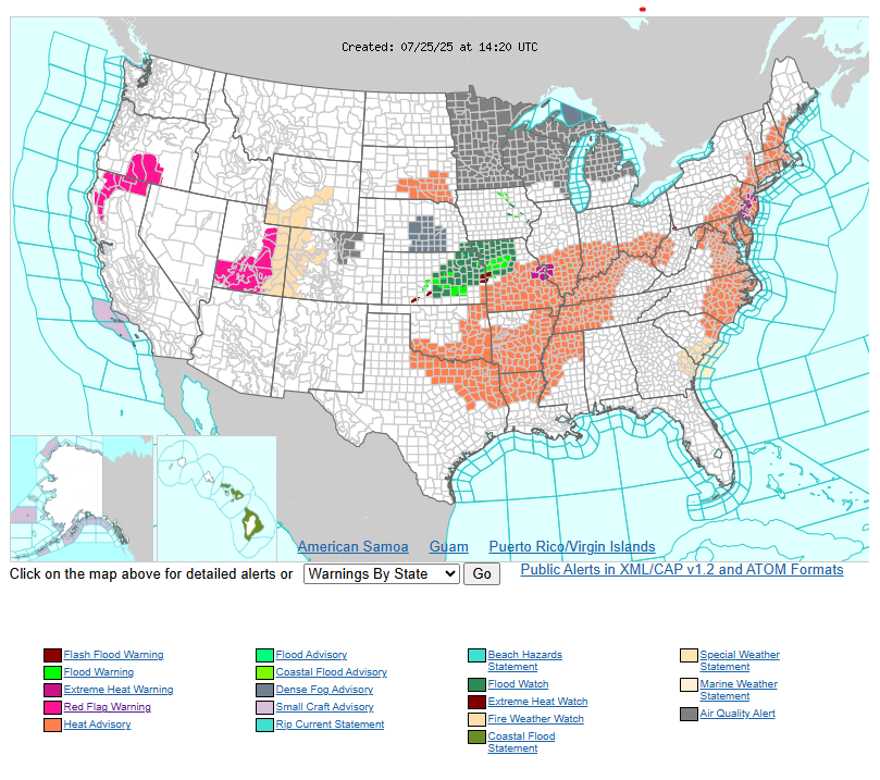
Unusual heat and humidity remain in place from the Middle Mississippi/Ohio Valleys through early next week, while building across the Southeast and Mid-South this weekend. Heat will be most persistent and dangerous across the Southeast and Tennessee Valley. There is high confidence that heat will reach levels that would affect anyone without sufficient cooling and/or adequate hydration, particularly across the Southeast.
WYOMING
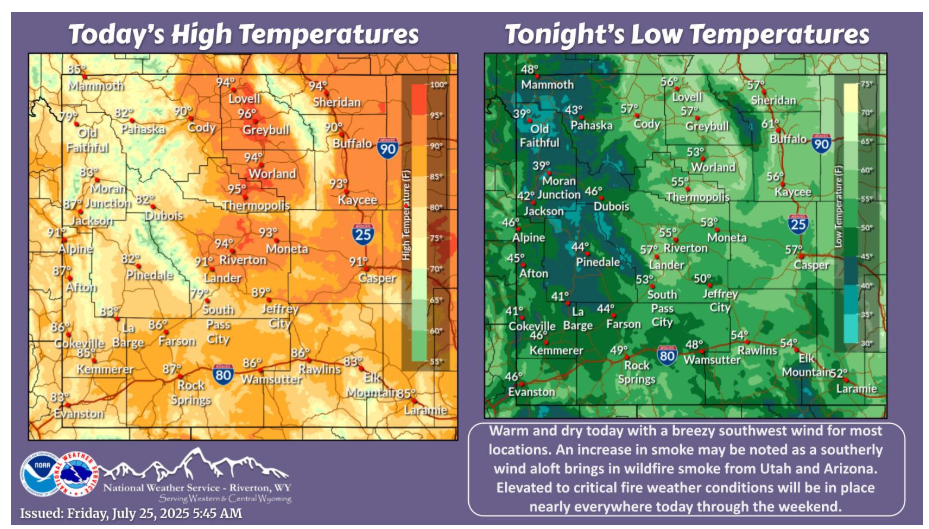
Warm and dry today with a breezy southwest wind for most locations. An increase in smoke may be noted as a southerly wind aloft brings in wildfire smoke from Utah and Arizona. Elevated to critical fire weather conditions will be in place nearly everywhere today through the weekend.
NEBRASKA
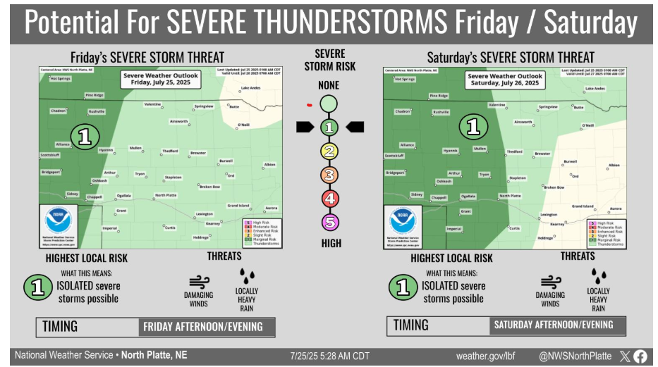
Thunderstorms are possible both this evening and tomorrow, primarily across western Nebraska. The main threat with storms both days will be damaging wind gusts.
Have a fantastic day!