
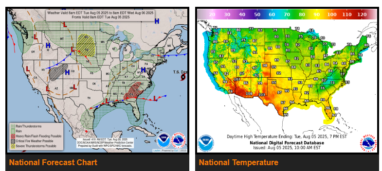
A front lingering from the Southeast westward along the Gulf Coast to the Southern Plains will remain quasi-stationary through Thursday. The front and tropical moisture will trigger showers and thunderstorms, accompanied by heavy rain, over parts of the Southeast/southern Mid-Atlantic.
Additionally, on Tuesday, another weak front over parts of the Northern Rockies/Northern High Plains will slowly move northeastward into South-Central Canada before dissipating on Thursday. The system, combined with a steady source of moisture, will produce showers and severe thunderstorms over parts of the Northern Plains.
Meanwhile, a front will begin to move onshore over the Pacific Northwest overnight Tuesday into Wednesday, moving eastward to the Northern High Plains, roughly southwestward to Northern California by Thursday. The storm will produce showers and rain over parts of the Pacific Northwest overnight Tuesday into Wednesday.
Moderate to heavy rain is expected to be associated with the thunderstorms over the Upper Midwest. Therefore, the WPC has issued a Marginal Risk (level 1/4) of excessive rainfall over parts of the Upper/Middle Mississippi Valley and Upper Great Lakes from Wednesday through Thursday morning.
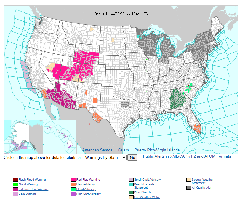
Heat Advisories are in effect for parts of Southern California, southern New Mexico, and southwestern Texas. Stay informed and take steps to protect yourself from heat-related illnesses.
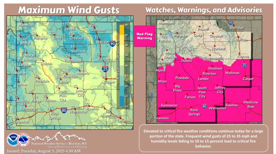
WYOMING
Have a fantastic day!