
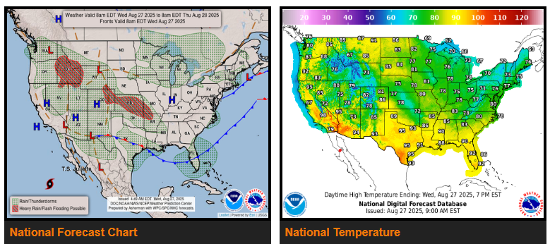
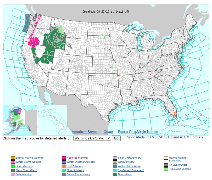
On Wednesday, storms will be more isolated in the Southwest and Great Basin, but an upper-level disturbance will bring heavier rain and a higher risk of flash flooding across the northern Intermountain West and Rockies.
By Thursday and Friday, storm activity will lessen in the Great Basin and Rockies as ridging builds, while temperatures remain above normal. Cooler conditions will gradually spread east, but the Northwest will still see warm overnight lows in the 60s and 70s through Wednesday night.
Heavy rainfall is expected across the central Rockies, High Plains, and into Kansas and Arkansas Wednesday and Thursday, with localized flash flooding possible, especially in urban areas. Storms shift toward Arkansas by Thursday, with a lower flooding threat by Friday.
Elsewhere, most of the U.S. will experience near or below-average temperatures, dipping more than 15° below normal in some areas. Record lows are possible in the Ohio Valley, Mid-Atlantic, and Northeast Wednesday night into Thursday morning.
WYOMING
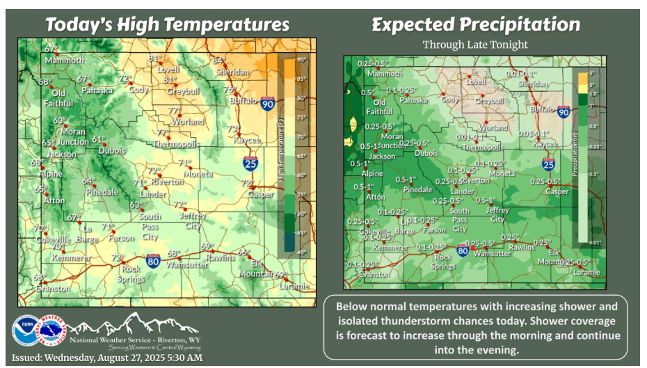
Below normal temperatures are forecast across the area today. Shower coverage increases during the morning hours with isolated thunderstorm chances this afternoon. Even though precipitation amounts have decreased, we are still expecting rain!
Have a fantastic day.