
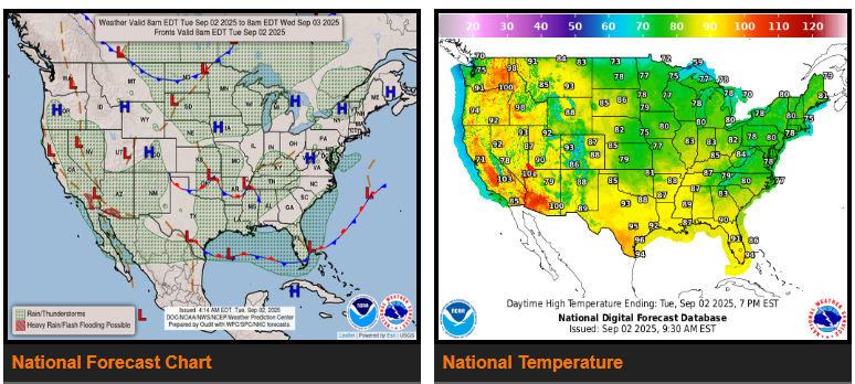
A stalled front stretching from Florida to southern Texas will continue to spark scattered showers and thunderstorms through midweek. Southern Florida will see the most activity as waves of low pressure move along the front, with heavy downpours possible that could cause localized flash flooding. By Wednesday and Thursday, drier air should push into Texas and much of the Gulf Coast as the front shifts farther south.
Across the Mid-South into the Tennessee Valley, a slow-moving system will bring unsettled weather with rounds of showers and thunderstorms. Some storms may produce heavy rainfall and isolated flash flooding. Clouds and rain will also keep temperatures a few degrees below normal.
Farther north, a strong cold front will sweep across the northern Plains and Upper Midwest today, reaching the Great Lakes, Ohio Valley, and central Plains midweek. This front will trigger more storms and heavy rain but its biggest impact will be the sharp drop in temperatures. Highs in parts of the Dakotas, Minnesota, and Wisconsin may only reach the 50s and 60s on Wednesday — up to 25 degrees below early September averages.
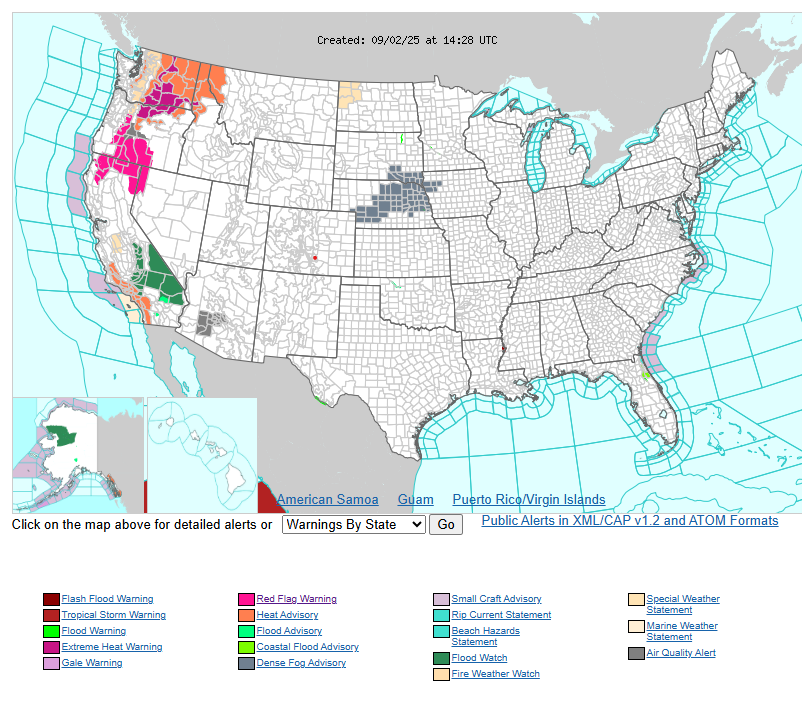
Meanwhile, west of the Rockies, hot weather will persist under a strong ridge of high pressure. The Pacific Northwest faces a multi-day heat wave, with temperatures topping 100°F in parts of Oregon and Washington. Heat Advisories and Excessive Heat Warnings remain in effect. Farther south, monsoon moisture will return to the Southwest and Four Corners region, bringing storm chances, localized flash flooding, and slightly cooler temperatures.
Have a fantastic day.