
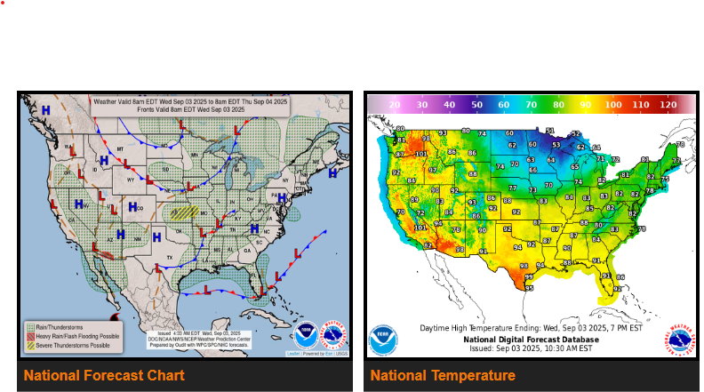
A strong cold front continues sweeping across the Great Lakes, Upper Midwest, and central Plains today, bringing much cooler air behind it. Temperatures will run 15–25 degrees below average for early September, with highs only in the 40s across far northern Minnesota and mainly in the 50s and 60s elsewhere in the northern Plains and Upper Great Lakes.
This front will also spark widespread showers and thunderstorms, with the potential for strong to severe storms across parts of the central Plains this afternoon and evening. Damaging winds and large hail are the main threats, though an isolated tornado can’t be ruled out. Storms will push eastward into the Ohio Valley, central Appalachians, interior Northeast, and Mid-Atlantic Wednesday night into Thursday, where additional strong storms may develop. A second cold front will follow Thursday into Friday, reinforcing another round of unseasonably cool air.
Farther south, a nearly stationary front over southern Florida will fuel multiple rounds of showers and thunderstorms through the next few days. Heavy downpours could lead to minor flooding or ponding on roads in poor drainage areas.
Out West, strong heating and increasing monsoonal moisture will support scattered to numerous thunderstorms across the Southwest and Four Corners region through week’s end. Heavy rain with these storms could result in isolated flash flooding, especially in southern Arizona, slot canyons, steep terrain, and burn scars.
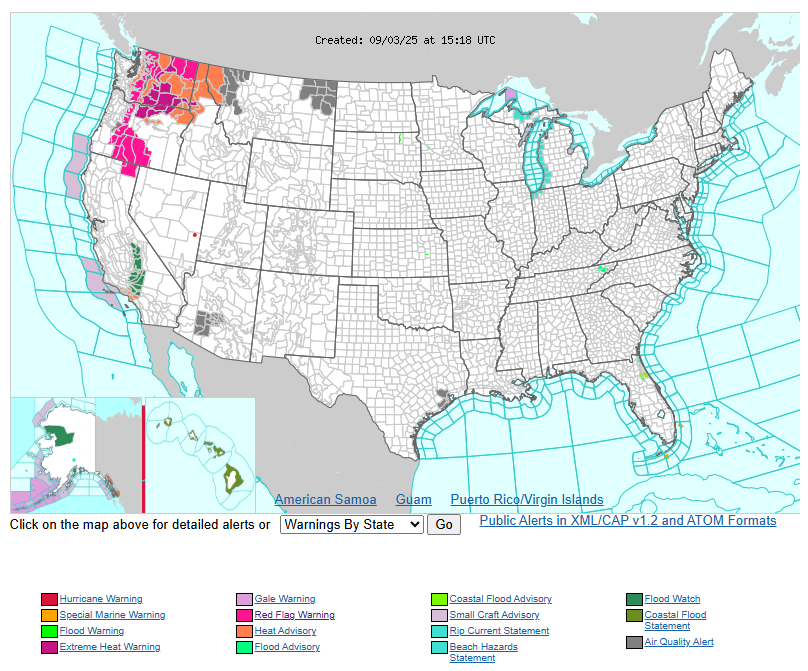
Meanwhile, the Pacific Northwest faces a significant late-season heat wave. Highs will climb into the 90s and low 100s today and Thursday, challenging daily and even monthly records. Excessive Heat Warnings and Heat Advisories are in effect for northern Oregon, eastern Washington, northern Idaho, and northwest Montana.
Have a fantastic day.