
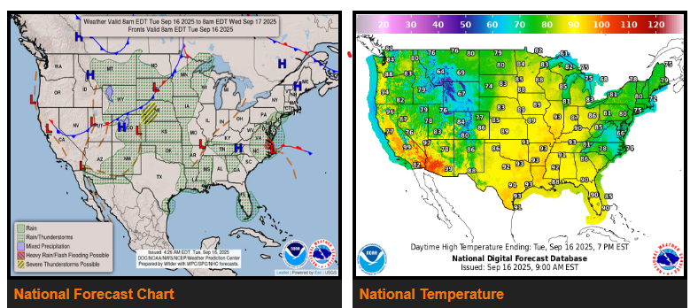
A more amplified weather pattern is taking shape across the U.S., leading to slow-moving systems with widespread impacts.
Mid-Atlantic:
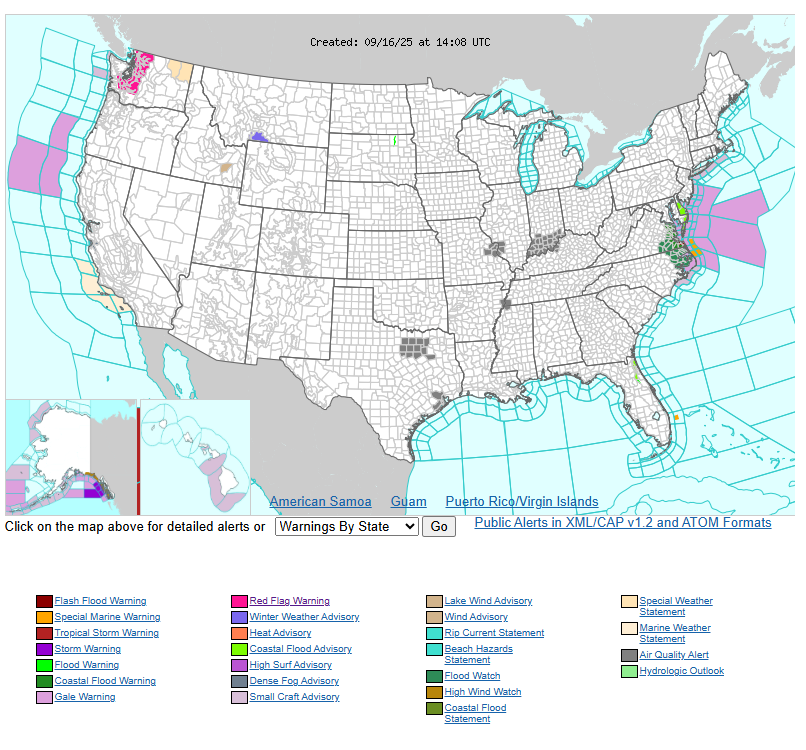
A developing low over the warm Gulf Stream is interacting with an upper-level low inland, steering the system toward eastern North Carolina and Virginia today. Moderate to heavy rain has already begun along the coast and will spread inland through the day. Stronger storms offshore are expected to move onshore as well. The system is forecast to stall tonight into Wednesday, keeping eastern Virginia, northeast North Carolina, and the southern Delmarva Peninsula at risk for 2–5 inches of rain over two days. While this area has been drier than normal recently, the rain could still lead to localized flooding.
Central U.S.:
Clusters of thunderstorms will bring rounds of heavy rain from the central to northern Plains today through Thursday as a system slowly pushes out of the Rockies. By midweek, the low will strengthen over the north-central U.S., keeping widespread showers and storms in place. This rain will provide some drought relief for parts of western Nebraska and southern South Dakota, though other areas are already fairly saturated from recent rainfall.
Southwest:
Tropical Storm Mario, located well off the Baja coast, will send moisture into southern California, Arizona, and New Mexico starting today. Although Mario is expected to weaken as it moves northwest, the tropical moisture will increase rain chances—first in southern coastal California and offshore islands Wednesday, then spreading farther north across much of southern California Thursday.
Temperatures:
Most of the U.S. will remain warmer than normal through the final week of summer. However, cooler conditions are expected in the Mid-Atlantic Tuesday–Wednesday and across the central to northern Plains Wednesday–Thursday where heavy rain is likely.
WYOMING
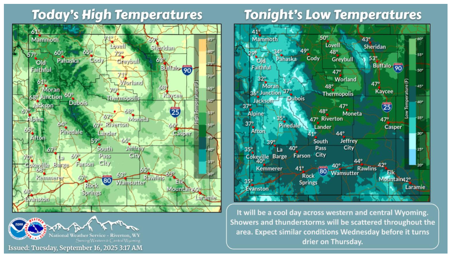
Another unsettled day across the area with a scattering of showers and thunderstorms. Tomorrow looks similar before drier weather moves in for Thursday and Friday.
NEBRASKA
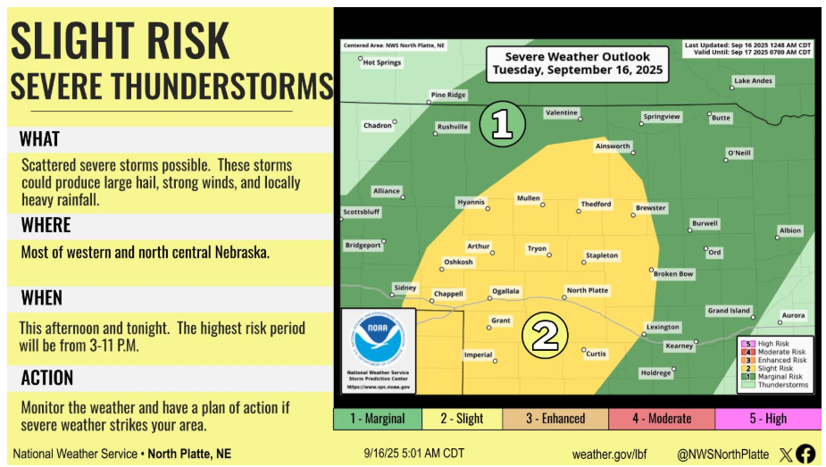
Scattered to widespread thunderstorms are expected to form ahead of a cold front this afternoon and tonight. Severe storms will be possible, with damaging wind gusts, large hail, and locally heavy rainfall as the main hazards.
Have a fantastic day!